Chaironeia
Greece /
Voiotia /
Levadia /
World
/ Greece
/ Voiotia
/ Levadia
, 6 km from center (Λεβάδεια)
World / Greece / Stereá Elláda
archaeological site, fortification, ancient ruins, Ancient Greece
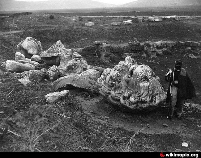
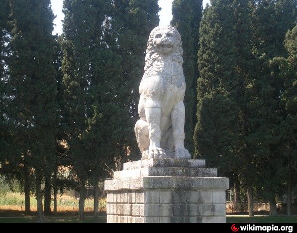

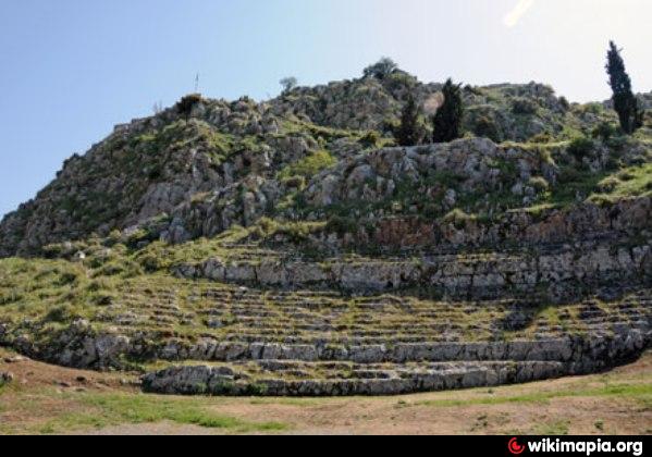
The ancient town of Chaironeia in Boeotia is located on a height to the southwest of the modern settlement. Philip II of Macedon famously defeated the Athenian-Theban alliance nearby in 338 BC. During the Middle Ages, the fortified settlement was known as Kapraina.
Wikipedia article: https://en.wikipedia.org/wiki/Chaeronea
Nearby cities:
Coordinates: 38°29'33"N 22°50'19"E
- Phokikon 8.8 km
- Ancient Orchomenos 10 km
- Αncient Abae 12 km
- Acropolis of ancient Elateia 18 km
- Ancient Haliartos 25 km
- Αncient Ascra 29 km
- Gla - Mycenaean Citadel 29 km
- Archaeological site of Delphi 30 km
- Thronium 34 km
- Thespiai 35 km
- Panopeus 3.8 km
- Daulis 10 km
- Davlia 10 km
- Mount Helicon 13 km
- Solar farm 14 km
- Distomon Substation 15 km
- Peripheral unit of Boeotia 26 km
- Μount Parnassus 27 km
- Gulf of Corinth 45 km
- Peripheral unit of Phthiotis 48 km