Lake Abyata
Ethiopia /
Oromia /
Negele /
World
/ Ethiopia
/ Oromia
/ Negele
World / Ethiopia / Oromia / East Shewa
lake, caldera


Lake Abyata is a terminal lake, and is fed by rivers, Hora Kelo, Bulbula and Gogesa. It's located west of Lake Langano, some 200 kilometers (124 miles) south of Addis Ababa, in the Main Ethiopian Rift (MER), at an altitude of 1,581 meters (5,186 feet).
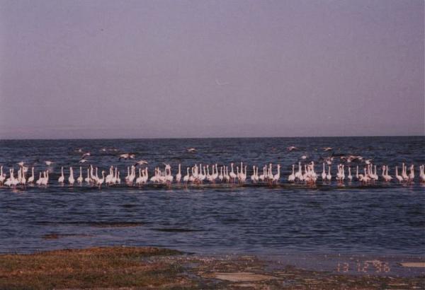
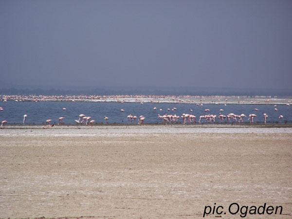
The lake is 14 kilometers (9 miles) long, and is up to 11 kilometers (7 miles) wide. Lakes Abyata and Shala form part of the Abyata-Shala National Park, and were known as feeding and breeding sites for vast flocks of birds, respectively. However, due to human activities, Lake Abyata appears to be shrinking at alarming rate.
en.wikipedia.org/wiki/Main_Ethiopian_Rift
en.wikipedia.org/wiki/O%27a_Caldera
Wikipedia article: http://en.wikipedia.org/wiki/Lake_Abijatta
Nearby cities:
Coordinates: 7°36'30"N 38°35'29"E
- Lake Shala 24 km
- Lake Ziway 60 km
- Lake Abaya 157 km
- Lake Chamo 221 km
- Lake Fincha 277 km
- Chew Bahir 375 km
- Lake Turkana 460 km
- Lake Abbe 531 km
- Grand Ethiopian Renaissance Reservoir 567 km
- Lake Bisina 841 km
- Lencha Tiko 4.1 km
- Abyata Shala National Park 11 km
- Tulu Fike (Mount Fike) 12 km
- Corbetti Volcano 51 km
- Wendo genet 58 km
- Senkelle Swayne's Hartebeest Sanctuary 59 km
- CPEL Awassa 60 km
- Wendo Genet Wetland 62 km
- Island In A Swamp 65 km
- Bilate River field 80 km