Habuba Kabira Süd
Syria /
Hhalab /
Dayr Hhafir /
World
/ Syria
/ Hhalab
/ Dayr Hhafir
, 39 km from center (دير حافر)
island, ruins, ghost town
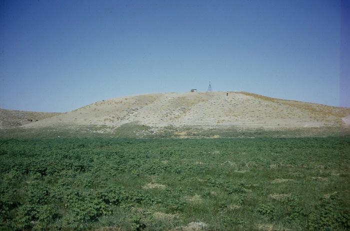
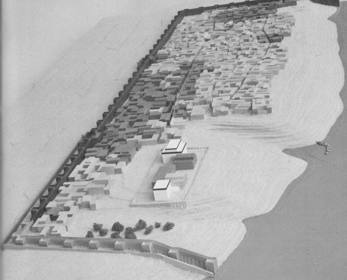
Habuba Kabira is an abandoned settlement dating back to Middle to Late Uruk Period (3500 BCE). The settlement is situated atop the now submerged Tell Kannas. The site encompasses roughly 18 hectares, 10 of which were walled off as part of the city. Habuba Kabira was abandoned sometime during the Late Uruk Period after about 150 years of occupation.
Tell Kannas was later occupied several times throughout the Middle to Late Bronze Ages. Tell Kannas was occasionally used as a burial ground during this time period as well as the Roman Era.
The site was excavated for 9 seasons from 1969 to 1975 by a Deutsche Orient-Gesellschaft team and for 8 seasons from 1967 to 1974 by a Comité belge de recherches historiques, épigraphiques et archéologiques en Mésopotamie team.
See Also: bareo.be/project/tell-kannas.html
Wikipedia article: https://en.wikipedia.org/wiki/Habuba_Kabira
Nearby cities:
Coordinates: 36°9'3"N 38°3'39"E
- Rasm al-Hammili 81 km
- Tabarah as-Sakhana 83 km
- Rasm Abū Albā 95 km
- Khirbat Umm al Mikbas 131 km
- Khirbat Jusiyah (Maurikopolis?) 237 km
- Khirbat Jarbu` 369 km
- Varosha [Maraş, Βαρώσια] 390 km
- Ancient City of Salamis 392 km
- Quneitra 394 km
- Kharaba 423 km
- Wādī Samrah river mouth 6.2 km
- Maskanah Subdistrict 18 km
- Tabqa Dam Reservoir / Lake Assad 23 km
- High Voltage Electricity Line 24 km
- Maskaneh Plain 26 km
- Al-Khafsah Subdistrict (PCS) 36 km
- Tabqa Civil Council (DFNS) 42 km
- Manbij-Birecik Plain 48 km
- Al-Raqqah Governorate 78 km
- Euphrates Region (DFNS) 79 km