Quneitra
Syria /
al-Qunaytirah /
World
/ Syria
/ al-Qunaytirah
/ al-Qunaytirah
, 1 km from center (القنيطرة)
World / Israel
ruins, ghost town

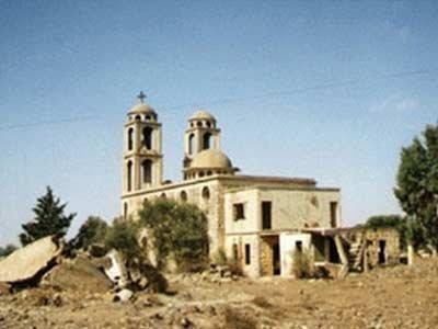
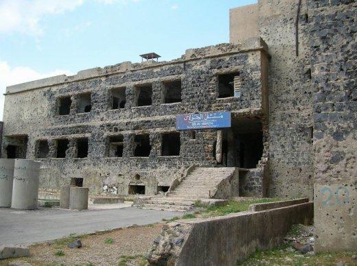
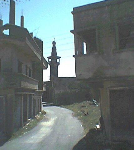
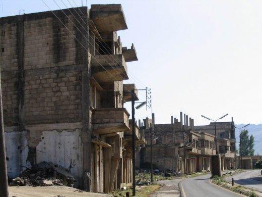
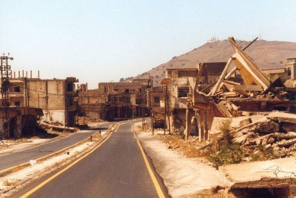
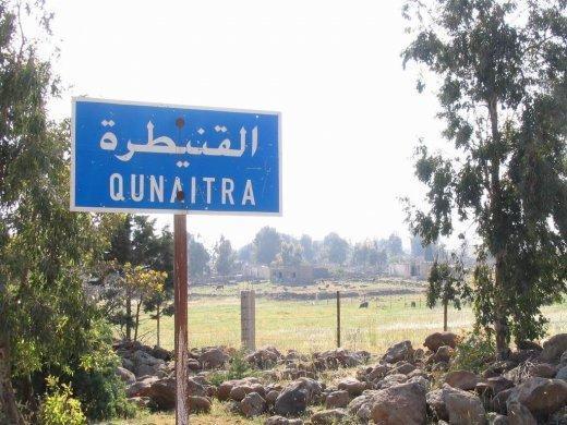
Quneitra (also Al Qunaytirah, Qunaitira, or Kuneitra; Arabic: القنيطرة) is the largely destroyed and abandoned capital of the Quneitra Governorate in south-western Syria. It is situated in a high valley in the Golan Heights at an elevation of 1,010 metres (3,313 feet) above sea level. Quneitra was founded in the Ottoman era as a way station on the caravan route to Damascus and subsequently became a garrison town of some 20,000 people, strategically located near the ceasefire line with Israel.Was captured by Israel in 1967 as part of the golan, but returned to Syria in the 1973 cease-fire agreements. The town was destroyed almost completely during the fighting, and the Syrians have chosen not to rebuild it. Today it stands as a ghost town - destroyed and almost completely deserted.
Wikipedia article: http://en.wikipedia.org/wiki/Quneitra
Nearby cities:
Coordinates: 33°7'29"N 35°49'34"E
- Kharaba 82 km
- Khirbat Jarbu` 101 km
- Khirbat Jusiyah (Maurikopolis?) 159 km
- Khirbat Umm al Mikbas 275 km
- Varosha [Maraş, Βαρώσια] 282 km
- Tall Mabtuhah 283 km
- Ancient City of Salamis 290 km
- Rasm Abū Albā 300 km
- Tabarah as-Sakhana 312 km
- Rasm al-Hammili 314 km
- UNDOF Zone 4.8 km
- Quneitra Governorate (PCS) 5.2 km
- Military Zone 10 km
- Military Zone 12 km
- Military Zone 13 km
- Military Zone 15 km
- Golan Plateau 15 km
- Golan Heights 15 km
- Galilee Panhandle 22 km
- Horan Plain 44 km
Comments