Shishmaref, AK
USA /
Alaska /
Shishmaref /
World
/ USA
/ Alaska
/ Shishmaref
World
third-level administrative division
Add category

2008 Population of 587.
Info: www.commerce.state.ak.us/dca/commdb/CIS.cfm?Comm_Boro_N...
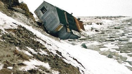
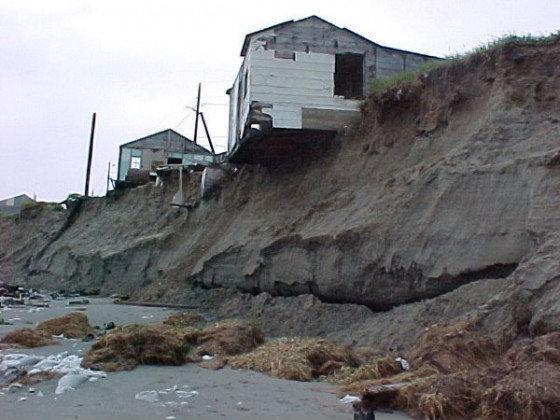
This study explores subsistence land use by residents of Shishmaref: (PDF)
www.poa.usace.army.mil/en/cw/shishmaref/Working_Landuse...
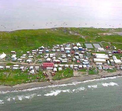
Numerous photos: www.commerce.state.ak.us/dca/photos/comm_photos.cfm?com...
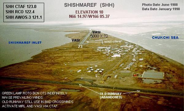
Detailed & annotated aerial imagery: www.dced.state.ak.us/dca/profiles/profile-maps.htm
Info: www.commerce.state.ak.us/dca/commdb/CIS.cfm?Comm_Boro_N...
This study explores subsistence land use by residents of Shishmaref: (PDF)
www.poa.usace.army.mil/en/cw/shishmaref/Working_Landuse...
Numerous photos: www.commerce.state.ak.us/dca/photos/comm_photos.cfm?com...
Detailed & annotated aerial imagery: www.dced.state.ak.us/dca/profiles/profile-maps.htm
Wikipedia article: http://en.wikipedia.org/wiki/Shishmaref,_Alaska
Nearby cities:
Coordinates: 66°14'58"N 166°5'6"W
- City of Edinburgh Council 6351 km
- Staffordshire Moorlands 6668 km
- Newcastle-under-Lyme Borough 6678 km
- Stafford 6693 km
- South Staffordshire 6715 km
- Wycombe District 6838 km
- North Devon 6867 km
- Borough of Basingstoke and Deane 6877 km
- Las Hurdes 8027 km
- Jerez de la Frontera 8428 km
- Shishmaref Inlet 12 km
- Ikpek Lagoon 59 km
- Lopp Lagoon 96 km
- Grantley Harbor 109 km
- Port Clarence Bay 117 km
- Imuruk Basin 127 km
- Imuruk Lake 150 km
- Imuruk Lake Volcano 150 km
- Bering Strait 151 km
- Golovnin Lagoon 229 km