Acropolis
Greece /
Argolis /
Ayia Triada /
World
/ Greece
/ Argolis
/ Ayia Triada
, 6 km from center (Αγία Τριάδα)
World / Greece / Peloponnisos
ruins, archaeological site, fortification, acropolis
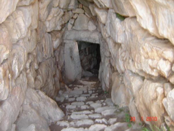
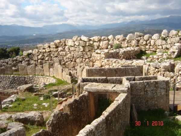
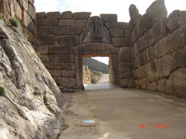
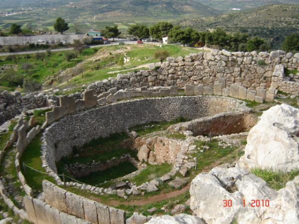
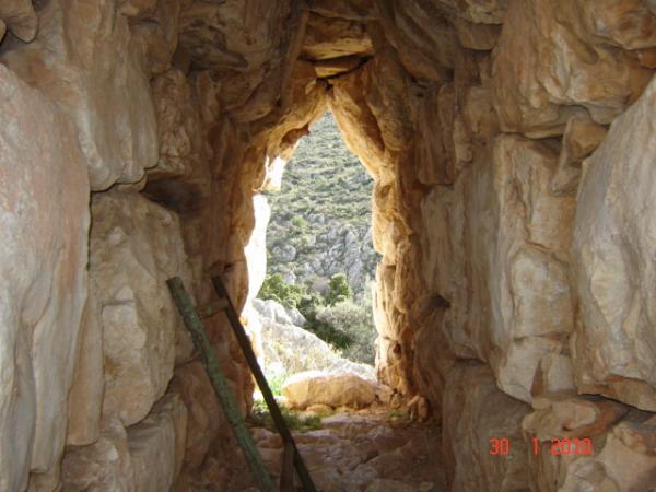
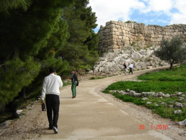

The acropolis of Mycenae served as the fortified citadel (remodeled several times) of both the Bronze-Age and later (Archaic, Classical) Greek city. The Western Annex (including Grave Circle A, the "Cult Center" and the Southwestern Quarter) and the Northeastern Annex (including Buildings Alpha and Beta and the tunnel to the water source) were the last areas added to the fortified perimeter, over the course of the 13th century BC. The Late Bronze Age citadel was protected by an impressive Cyclopean wall, with two main gates (the Lion Gate in the northwest, the North Gate or Postern Gate in the north, but also a small sally port next to the tunnel in the Northeastern Annex). Atop the summit in the center of the acropolis was located the Bronze Age palace, later partly overlapped and effaced by Iron-Age temples at the summit. The fortifications and neighboring structures along much of the southern edge of the citadel are lost due to hill erosion into the ravine to the south (the southern corner of the megaron has been restored during conservation).
An overview of the archaeological site of Mycenae: www.odysseyadventures.ca/articles/mycenae/article_mycen...
An overview of the archaeological site of Mycenae: www.odysseyadventures.ca/articles/mycenae/article_mycen...
Wikipedia article: https://en.wikipedia.org/wiki/Mycenae
Nearby cities:
Coordinates: 37°43'49"N 22°45'28"E
- Mycenae 0.6 km
- Archaia Nemea 10 km
- Acropolis 11 km
- Ancient city of Kleonai 11 km
- Acrocorinth 21 km
- The Harbor of Lechaion 25 km
- Archaeological Site of Isthmia 29 km
- The Fortress and the Hexamilion 29 km
- Diolkos Corinth (Railway) 30 km
- Leuktra (Leuctra) 69 km
- Mycenaean Tombs 0.9 km
- Σάρα 1.3 km
- Αγιολιάς - Mount Profitis Ilias (804 m) 1.5 km
- Restaurant. 2.2 km
- Mycenaean Road 3.5 km
- Argos Moto Cross Park 5.1 km
- Derbenaki Pass 7 km
- Parnavos 9 km
- Peripheral unit of Corinthia 22 km
- Peripheral unit of Argolis 23 km
Comments