Dibsī ‘Afnān
Syria /
ar-Raqqah /
at-Tawrah /
World
/ Syria
/ ar-Raqqah
/ at-Tawrah
, 36 km from center (الثورة)
draw only border, underwater/submerged village
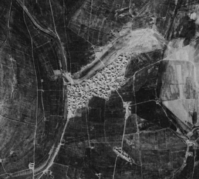
Dibsī ‘Afnān (Arabic: دبسي عفنان ) is a former village in Syria. It was flooded in 1974 when Tabqa Dam was built.
Aerial image is from 1968 (photo credit: Center for Advanced Spatial Technologies, University of Arkansas/U.S. Geological Survey).
Aerial image is from 1968 (photo credit: Center for Advanced Spatial Technologies, University of Arkansas/U.S. Geological Survey).
Nearby cities:
Coordinates: 35°55'56"N 38°15'49"E
- Al Wāsiţah 3.6 km
- Abū Zurayjīyah 4.9 km
- Zapalnya (submerged village) 1300 km
- Former Poreci island 1669 km
- Dharaji Water Fall (Gone - submerged) On Maa Narmada River 3970 km
- Chapra Ghat (Now Submerged) 4005 km
- Ancient city of Junxian (均县) 6551 km
- Big Ripples, California 11373 km
- Sunken Harbor 11976 km
- Villa Sauri (submerged) 13211 km
- Al Wāsiţah 3.8 km
- Abū Zurayjīyah 4.5 km
- High Voltage Electricity Line 11 km
- Tabqa Dam Reservoir / Lake Assad 15 km
- Tabqa Civil Council (DFNS) 20 km
- Maskanah Subdistrict 21 km
- Maskaneh Plain 24 km
- Al-Mansurah Subdistrict (PCS) 47 km
- Al-Raqqah Governorate 59 km
- Euphrates Region (DFNS) 71 km