Malaysia Airlines Flight 17 Crash Site
Ukraine /
Donetska /
Pelahiyivka /
World
/ Ukraine
/ Donetska
/ Pelahiyivka
, 7 km from center (Пелагіївка)
invisible, aircraft crash site
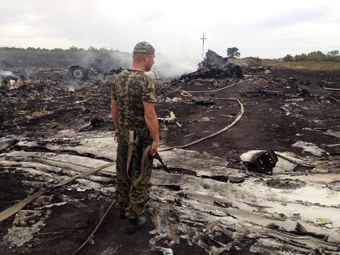
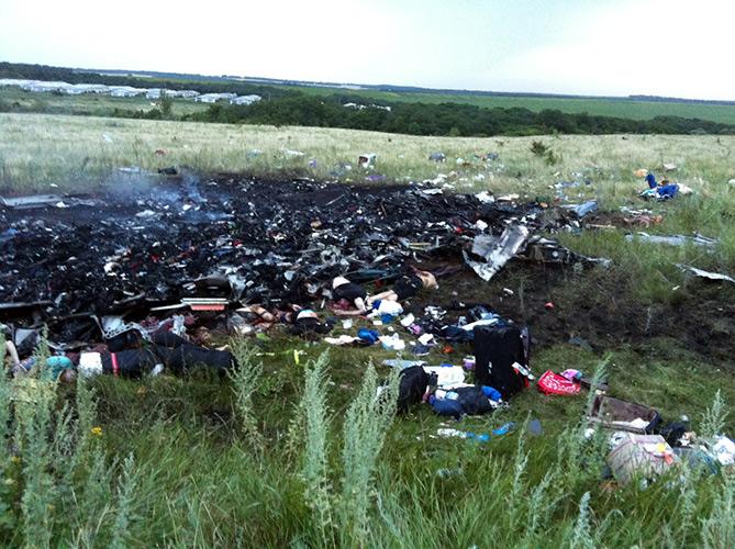
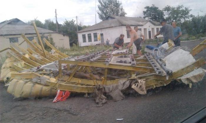
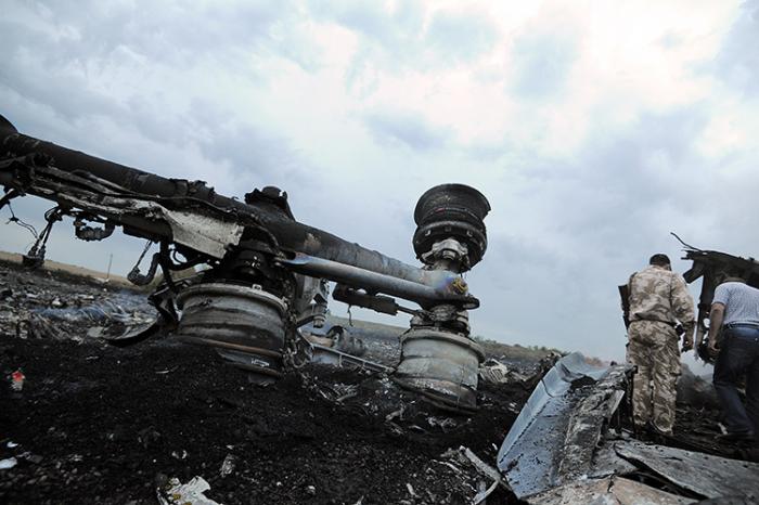

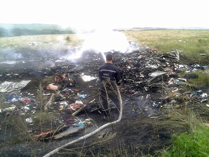
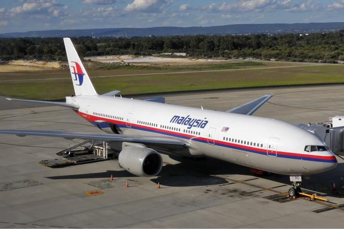
Malaysia Airlines Flight 17 was a scheduled international passenger flight from Amsterdam to Kuala Lumpur, operated by a Boeing 777-200ER that crashed at this location near Hrabove in Donetsk Oblast, Ukraine, 40 km/25mi from the border with Russia on its July 17th, 2014 flight. The aircraft was carrying 280 passengers and 15 crew members, none of whom survived the accident.
Based on the preliminary findings of the Security Council of the Netherlands (Dutch Safety Board) released in September of 2014, the aircraft was impacted by a "large number of high-energy objects from outside the aircraft", data consistent with the close-proximity detonation of a surface-to-air missile, while operating at its cruising altitude of 10,000m/33,000ft. These findings were later confirmed by the final report on the loss of MH17 issued on October 13th, 2015 issued by the Security Council of the Netherlands (Dutch Safety Board), which concluded that at 13.20hrs UTC a 9N314M warhead launched by a Buk surface-to-air missile system operating within from a 320 sq/km area in the eastern part of Ukraine detonated outside the forward left hand side of the aircraft and led to the subsequent breaking up of the aircraft in mid-flight and loss of all 298 persons aboard.
Full Report PDF
cdn.onderzoeksraad.nl/documents/report-mh17-crash-en.pd...
Wikipedia article: http://en.wikipedia.org/wiki/Malaysia_Airlines_Flight_17
Nearby cities:
Coordinates: 48°8'17"N 38°38'20"E
This article is protected.
- AN2 Crash Site 16.07.2022 389 km
- IL-76 crash site 24.06.2022 725 km
- 2010 Polish Air Force Tu-154 crash 873 km
- Crash site a polish aircraft PLL "LOT" Lockheed L-14H - 22 July 1938 957 km
- 2023 Tver plane crash 1115 km
- 24 January 1969 AN-24B PLL LOT crash site 1593 km
- Scandinavian Airlines Flight 751 ("Miraklet i Gottröra"/"Miracle in Gottröra") crash site 1851 km
- Partnair Flight 394 crash site 2169 km
- Crash Site of Germanwings Flight 4U-9525 2499 km
- Approximate crash site of Spitfire Vb AB822 piloted by Sgt Leonard Stock (killed), 26 Oct 1941 2668 km
- Hrabova Arroyo 1.8 km
- Hrabivskyi Forest 2 km
- Hrabove urotshistshe 2.2 km
- Botanical natural monument of national importance "Hrabove urotshistshe" 2.5 km
- Nezhebyna Arroyo 3.2 km
- Hrabivske Reservoir 3.4 km
- Hlukhivskyi forest 4.7 km
- Hlukha Balka arroyo 5.3 km
- Faschivka ravine 7 km
- Stozhkova Arroyo 10 km
Comments