24 January 1969 AN-24B PLL LOT crash site (Wroclaw)
Poland /
Dolnoslaskie /
Wroclaw
World
/ Poland
/ Dolnoslaskie
/ Wroclaw
aircraft crash site
Add category
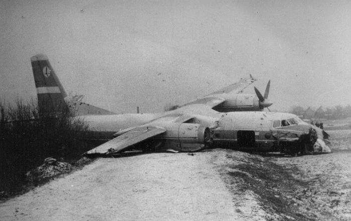
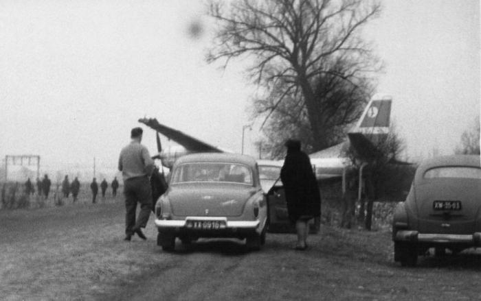
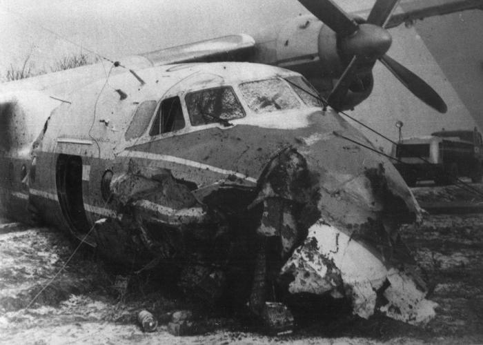
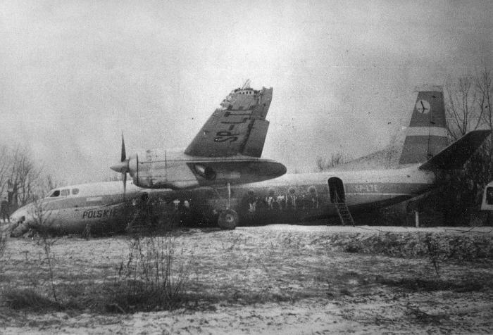
The Antonov took off at 16:35 for a flight to Wroclaw. After passing the NDB, the flight was now descending towards the Outer Marker, Wroclaw Control Zone warned that the visibility had deteriorated to 800 m (minimum = 1100 m). The approach was continued and the aircraft passed the Outer Marker at 50-60 m (instead of 225 m). The pilot was then advised that the visibility had further deteriorated to 400 m, but he still continued. At a height of 10 m (700 m past the Outer Marker) the wings struck treetops. Part of the right wing broke off and the aircraft banked 40deg to the right. The Antonov struck 2 30.000 Volt power lines, electric traction cables of a railway and slid on the ground, coming to rest on a road.
PROBABLE CAUSE: "The accident was attributed to the decision of the pilot in command to carry out an approach in weather conditions below the minimum limits prescribed for Wroclaw Airport and his non-observance of the prescribed altitude over the outer radio beacon while performing the approach procedure. The accident was the pilot-in-command's fault as well as the co-pilot's since the latter did not prevent the pilot-in-command from violating the flight rules."
aviation-safety.net/database/record.php?id=19690124-0
www.airliners.net/photo/LOT-Polish-Airlines-Polskie-Lin...
Nearby cities:
Coordinates: 51°5'14"N 16°56'17"E
- Crash site a polish aircraft PLL "LOT" Lockheed L-14H - 22 July 1938 761 km
- Partnair Flight 394 crash site 862 km
- Scandinavian Airlines Flight 751 ("Miraklet i Gottröra"/"Miracle in Gottröra") crash site 970 km
- Approximate crash site of Spitfire Vb AB822 piloted by Sgt Leonard Stock (killed), 26 Oct 1941 1076 km
- Crash Site of Germanwings Flight 4U-9525 1090 km
- 2010 Polish Air Force Tu-154 crash 1093 km
- 2023 Tver plane crash 1322 km
- IL-76 crash site 24.06.2022 1569 km
- Malaysia Airlines Flight 17 Crash Site 1591 km
- AN2 Crash Site 16.07.2022 1907 km
- Mokronos Railway Substation 0.6 km
- PGF sp. z o.o. 1.4 km
- Oporów 1.7 km
- Abandonded Park 1.8 km
- handelot.com Sp. z o.o. 1.8 km
- Klecina 3.6 km
- Wrocław Krzyki (district) 8 km
- Psie Pole (district) 10 km
- Gmina Kąty Wrocławskie 10 km