Roman Road
Bulgaria /
Haskovo /
Madzharovo /
World
/ Bulgaria
/ Haskovo
/ Madzharovo
, 7 km from center (Маджарово)
World / Bulgaria / Haskovo
archaeological site, Roman Empire, interesting place
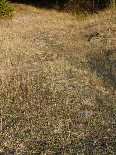
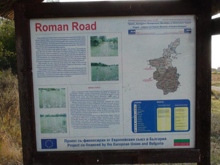
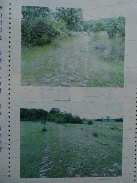
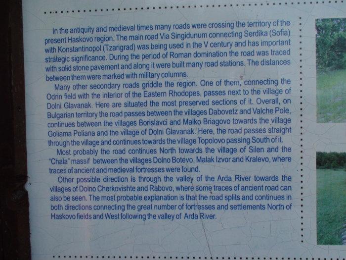

Since the most ancient times and the Middle Ages until the present days many important roads and connecting routes have crossed the territory of Haskovo region. One of these routes is the main road Via Singidunum which connected Serdica (Sofia) to Constantinople (Istanbul). This road has been used since the V century BC, and was of major strategic importance in the past. During the period of Roman rule the road was further improved with solid cobbled stones laid and road stations built. The distance passed was bench-marked by special encrypted columns, some of which are now kept in the Regional Historical Museum in the town of Haskovo.
It is believed that a part of the Via Singidunum is still preserved nowadays in Gaberovo. The route of the road passes directly through the village of Dolni Glavanak and then continues in the direction of the village of Topolovo – and the traces of the Roman road get lost in the plowed fields. From there the road most probably branched into two separate directions – first to the north to the Chala Hill, where traces of ancient and medieval fortresses were found and second along the valley of the sacred Arda River, where signs of an old road can also be found.
visitbulgaria.com/the-roman-road-village-of-dolni-glava...
www.youtube.com/watch?v=BPhQiQUpHCY
Nearby cities:
Coordinates: 41°41'13"N 25°49'50"E
- Gluhite Kamani Rock-cult Complex 11 km
- Mosynopolis 75 km
- Ancient Stronghold Ulpia Augusta Traiana 85 km
- Erkesia 88 km
- Garella 92 km
- Vyaditsa 97 km
- Kabile National Archaeological Reserve 110 km
- Antique Town of Kabile 110 km
- Deultum National Archaeological Reserve 141 km
- Brodilovo 174 km
- Dolni Glavanak Resevoir 1.9 km
- Chernata Skala Protected Site 3.5 km
- Ancient and Medieval Fortress “Papaz Kaya“ 3.9 km
- Madzharovo Municipality 4.4 km
- Momina Skala Protected Site 6.1 km
- Haskovo Province 10 km
- Stambolovo Municipality 12 km
- Krumovgrad Municipality 26 km
- Ivaylovgrad Municipality 26 km
- Rhodope National Park 69 km