High Line Bridge
USA /
North Dakota /
Valley City /
World
/ USA
/ North Dakota
/ Valley City
World / United States / North Dakota
trestle (bridge), railway bridge, 1908_construction
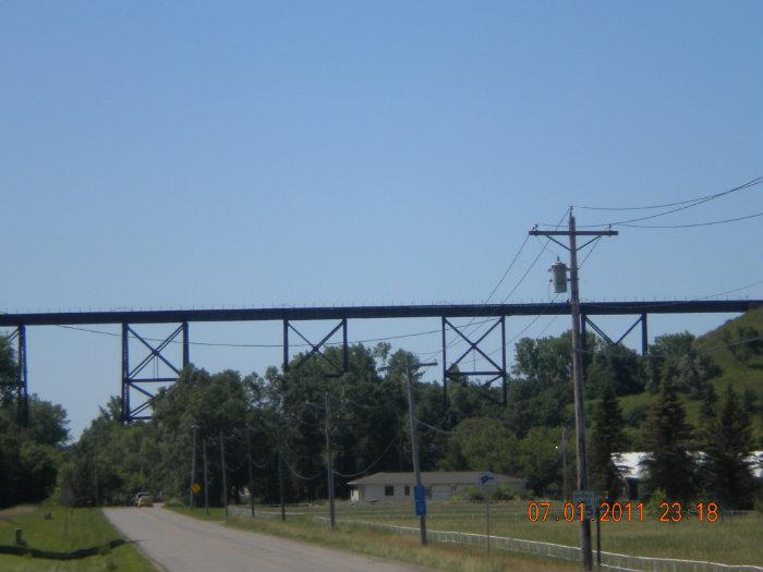
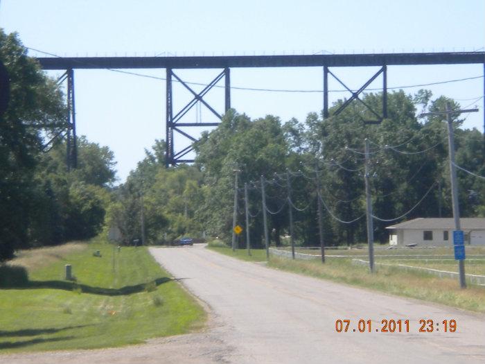
This bridge was opened in 1908 by the Northern Pacific Railroad. The trestle stands 162 feet (49m) above the Sheyenne River, and spans 3860 feet (1180m).
www.ndtourism.com/whatdo/attractions/attraction-details...
www.ndtourism.com/whatdo/attractions/attraction-details...
Wikipedia article: http://en.wikipedia.org/wiki/Hi-Line_Railroad_Bridge
Nearby cities:
Coordinates: 46°56'19"N 97°59'27"W
- CMSP&P Judith River Trestle 884 km
- CMR Judith River Trestle 890 km
- CMSP&P Sage Creek Trestle 892 km
- BNSF Railway Teton River Trestle 1045 km
- Lucin Cutoff - Union Pacific Railroad 1345 km
- The Myra Canyon - KVR Historic Trestles 1605 km
- Hewett Ave (US Hwy 2) Trestle 1817 km
- Redding Trestle 2075 km
- Trestle Glen Arm 2226 km
- Dumbarton Rail Bridge (Burned Portion) 2238 km
- Barnes County Municipal Airport (6D8) 1.9 km
- Bjornson Park Public Golf Course 4.3 km
- McDonald Lake 6.9 km
- Columbia Grain Midwest Division Valley City Receiving Facility 7.9 km
- Hobart Lake 11 km
- St.Marys Lake 16 km
- Moon Lake 16 km
- Lake Ashtabula 24 km
- Kee Lake 25 km
- Fort Ransom State Park 43 km