The Nature trail in Nagliai Nature Reserve
Lithuania /
Klaipedos /
Neringa /
World
/ Lithuania
/ Klaipedos
/ Neringa
World / Lithuania / Klaipedos
valley, pedestrian area, interesting place
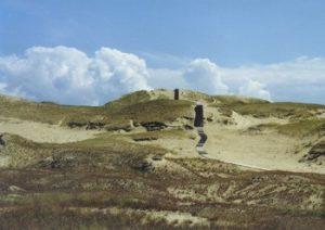
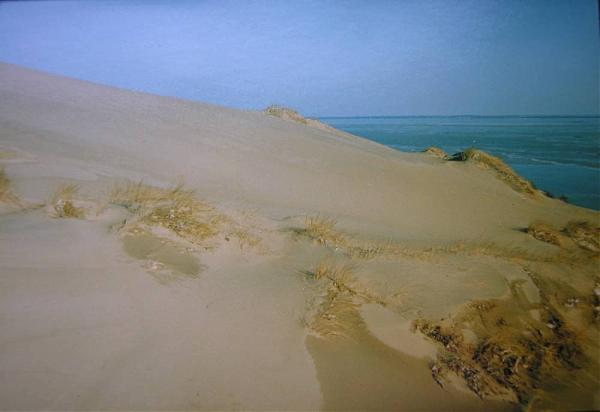
The area of the Nagliai Nature Reserve is 1680 ha. It stretches from the north to the south for 8 km and it is 2 km wide on average. The highest dunes are Agila (53m) and Vingio (48m). The entire length of the dunes is made up of ravines of the most intricate patterns blown by the wind and sand hills covered with grassy flora. Because of the colour of the prevailing flora the dunes are called “the grey”. Between 1675 and 1854 the sand blown by the western winds buried four villages of Nagliai in this area. Later the inhabitants of the last Nagliai formed two new settlements - Preila and Pervalka.
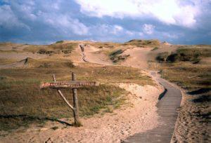
To allow visitors to learn about the landscape of the dunes a Nature Trail is set up on the reserve near a parking lot-15km marker of Nida-Juodkrante bicycle path or 31 km of Smiltynė-Nida road. Only here are visitors allowed to visit the strict nature reserve area. The natural environment of the reserve is especially sensitive to visitors, so people are asked to keep strictly to this path when walking in this area.
To allow visitors to learn about the landscape of the dunes a Nature Trail is set up on the reserve near a parking lot-15km marker of Nida-Juodkrante bicycle path or 31 km of Smiltynė-Nida road. Only here are visitors allowed to visit the strict nature reserve area. The natural environment of the reserve is especially sensitive to visitors, so people are asked to keep strictly to this path when walking in this area.
Nearby cities:
Coordinates: 55°26'26"N 21°4'48"E
- Autumn bird ringing station 0.6 km
- Traditional Houses and amber museum 15 km
- Parnidis dune (also known as "The Lithuanian Sahara") 17 km
- Sundial 17 km
- Death Valley 18 km
- The westernmost point of Lithuania 19 km
- Curonian Spit 48 km
- Church. 56 km
- Baltic Sea Biosphere polygon 11 km
- Curonian Lagoon maritime plain 15 km
- Curonian Lagoon 20 km
- Nemunas pre-valley 30 km
- Šilutė district municipality 31 km
- Outer roadstead of Klaipėda sea port 33 km
- Klaipėda district municipality 35 km
- Sambian Plateau Biosphere polygon 40 km
- Northwest Samogitian moraine plain 58 km
- Exclusive economic zone of Lithuania 81 km