Baltic Sea Biosphere polygon
Lithuania /
Klaipedos /
Neringa /
World
/ Lithuania
/ Klaipedos
/ Neringa
nature conservation park / area, Natura 2000, draw only border
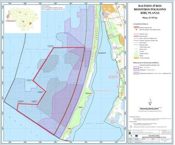
Situated westwards from Curonian Spit, covers an area of 31959 hectares. Established by Lithuanian Ministry of Environment in 2013 05 23 in order to preserve valuable area of Baltic Sea ecosystem.
Nearby cities:
Coordinates: 55°25'24"N 20°53'34"E
- Curonian Spit National Park (Russia) 30 km
- Curonian Spit 42 km
- Sambian Plateau Biosphere polygon 51 km
- Zelau Moor 95 km
- Vistula Spit 138 km
- Hel 161 km
- Słowiński National Park 255 km
- Tuchola Forest National Park 279 km
- Krajna Landscape Park 313 km
- Puszcza Zielonka Landscape Park 403 km
- Curonian Spit 11 km
- Curonian Lagoon 16 km
- Nemunas pre-valley 21 km
- Curonian Lagoon maritime plain 26 km
- Sambian Plateau Biosphere polygon 28 km
- Outer roadstead of Klaipėda sea port 34 km
- Šilutė district municipality 42 km
- Klaipėda district municipality 46 km
- Northwest Samogitian moraine plain 65 km
- Exclusive economic zone of Lithuania 71 km