Ugarit
Syria /
al-Ladiqiyah /
World
/ Syria
/ al-Ladiqiyah
/ al-Ladiqiyah
, 6 km from center (اللاذقية)
World / Syria / Lattakia
ruins, archaeological site, tell (mound), UNESCO World Heritage Site


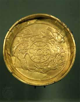

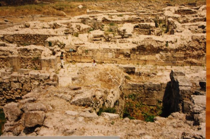

Ugarit (Ugaritic: 𐎜𐎂𐎗𐎚, modern site Ras Shamra رأس شمرة; meaning "top/head/cape of the wild fennel" in Arabic) was an ancient cosmopolitan port city, sited on the Mediterranean coast of northern Syria a few kilometers north of the modern city of Latakia. Ugarit sent tribute to Egypt and maintained trade and diplomatic connections with Cyprus (called Alashiya), documented in the archives recovered from the site and corroborated by Mycenaean and Cypriot pottery found there. The polity was at its height from ca. 1450 BC until 1200 BC.
Contents
www.youtube.com/watch?v=KElPnD-dbkk
Contents
www.youtube.com/watch?v=KElPnD-dbkk
Wikipedia article: http://en.wikipedia.org/wiki/Ugarit
Nearby cities:
Coordinates: 35°36'8"N 35°47'6"E
- Mashtá at Tūtah 41 km
- Tall Mabtuhah 52 km
- Sugar Factory 54 km
- Ancient city of Apamea 58 km
- City Wall 58 km
- Bara - ancient Kapropera 68 km
- Raphanaia / Rafaniyyah 91 km
- Khirbat `Arif 99 km
- Elaiussa Sebaste (Cilicia) 176 km
- Salamis 178 km
- Acropolis 0.1 km
- South Acropolis Trench 0.1 km
- North-West Quarter 0.2 km
- Minat al-Bayda Naval Base 1.6 km
- إحدى حارات آل العبدة 3 km
- Latakia Subdistrict (Nahiyah) 4.5 km
- Baksa 4.8 km
- Latakia Coastal Plain 17 km
- Latakia Governorate (PCS) 17 km
- Bargylus Mountains 34 km