West India Quay DLR Station (London)
United Kingdom /
England /
Westham /
London
World
/ United Kingdom
/ England
/ Westham
World / United Kingdom / England
light rail station, Docklands Light Railway
West India Quay DLR station is a station on the Docklands Light Railway in London, England. It is situated at the point where the line from Lewisham splits into branches to Tower Gateway/Bank and Stratford. The next stations on each line are Canary Wharf DLR station (to Lewisham), Westferry (to Tower Gateway/Bank) and Poplar DLR station (to Stratford). The station is in Travelcard Zone 2.
The station opened in 1987, but was closed from 1991 to 1993 as the surrounding area was rebuilt. The station is near to the Museum in Docklands and the adjoining hotel and leisure facilities on the north quay of West India Docks, and indeed the platforms of the station extend over part of the dock.
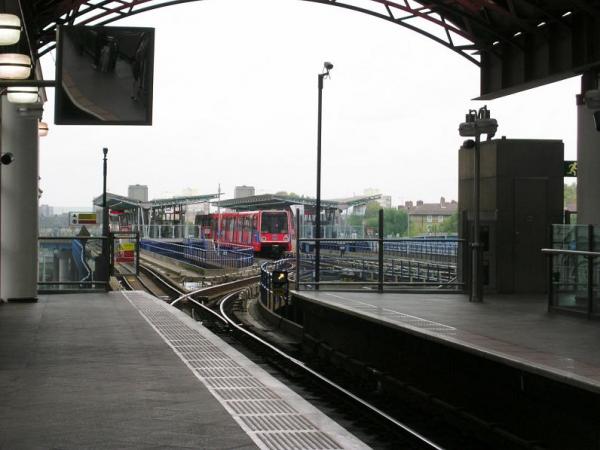
The station has four tracks and two island platforms. In normal traffic the platforms are used, in west to east order, for trains to Westferry, trains to Poplar, trains from Westferry, and trains from Poplar.
The distance from West India Quay DLR to Canary Wharf DLR is just 0.08 miles (approx 130 metres), the shortest distance on the entire London Underground and Docklands Light Railway system. Indeed, while standing at the station, the platforms for Canary Wharf are clearly visible just down the line.
The station opened in 1987, but was closed from 1991 to 1993 as the surrounding area was rebuilt. The station is near to the Museum in Docklands and the adjoining hotel and leisure facilities on the north quay of West India Docks, and indeed the platforms of the station extend over part of the dock.
The station has four tracks and two island platforms. In normal traffic the platforms are used, in west to east order, for trains to Westferry, trains to Poplar, trains from Westferry, and trains from Poplar.
The distance from West India Quay DLR to Canary Wharf DLR is just 0.08 miles (approx 130 metres), the shortest distance on the entire London Underground and Docklands Light Railway system. Indeed, while standing at the station, the platforms for Canary Wharf are clearly visible just down the line.
Wikipedia article: http://en.wikipedia.org/wiki/West_India_Quay_DLR_station
Nearby cities:
Coordinates: 51°30'24"N -0°1'13"E
- Canary Wharf DLR Station 0.1 km
- Depot – Docklands Light Railway 0.3 km
- Limehouse Station 1.6 km
- Island Gardens DLR 2.1 km
- Pudding Mill Lane DLR station 3.1 km
- Greenwich Railway and DLR Station 3.2 km
- Stratford High Street DLR station 3.8 km
- Elverson Road DLR station 4.2 km
- Lewisham Railway Station 4.6 km
- Docklands Light Railway Train Depot 6.5 km
- Poplar 0.6 km
- Millwall 1.4 km
- Tower Hamlets Council 1.4 km
- Isle of Dogs 1.4 km
- Cubitt Town 1.7 km
- Greenwich Peninsula 2.5 km
- Greenwich 2.6 km
- Lower Lea Valley 2.8 km
- London Borough of Newham 4.7 km
- Royal Borough of Greenwich 6.5 km