Raminho
Portugal /
Acores /
Angra /
World
/ Portugal
/ Acores
/ Angra
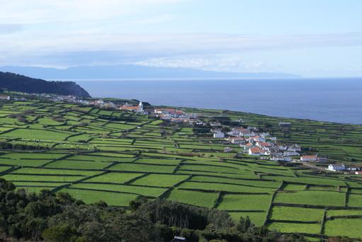
A village that was formerly part of Altares, but due to long distance to travel to church, the people there built their own and now have their own village. Actually each village extends from one neighboring place to the next. So Raminho really extends from Altares on the one side to Serreta on the other.
Wikipedia article: http://en.wikipedia.org/wiki/Raminho
Nearby cities:
Coordinates: 38°47'14"N 27°19'56"W
- Ribeira dos Gatos 1.1 km
- Caldeira de Santa Barbara 4.3 km
- Serreta 4.4 km
- Misterios Negros 6.7 km
- Fontinhas 20 km
- Porto Martins 26 km
- Piedade 75 km
- Mistério da Prainha 87 km
- caldeira do faial 123 km
- Sao Roque, Ponta Delgada 185 km
- Altares 2.8 km
- Biscoitos 6.5 km
- Cinco Ribeiras 11 km
- Terceira Island 13 km
- Agualva 14 km
- Reserva Geologica Natural 14 km
- Monte Brazil 18 km
- Lajes Field AB (TER/LPLA) 21 km
- Ilha de S. Jorge 63 km
- Pico Island 90 km