Ennis Municipal Airport (Ennis, Texas)
USA /
Texas /
Garrett /
Ennis, Texas
World
/ USA
/ Texas
/ Garrett
World / United States / Texas
airport
Add category
www.txdot.gov/publications/aviation/directory/f41.pdf
www.globalair.com/airport/airport.aspx?aptcode=F41
www.airnav.com/airport/F41
FAA Identifier: F41
www.globalair.com/airport/airport.aspx?aptcode=F41
www.airnav.com/airport/F41
FAA Identifier: F41
Nearby cities:
Coordinates: 32°19'48"N 96°39'50"W
- Dallas-Fort Worth International Airport (DFW/KDFW) 81 km
- Naval Air Station Fort Worth Joint Reserve Base (KNFW/FWH) 90 km
- Sheppard Air Force Base/Wichita Falls Municipal Airport (SPS/KSPS) 255 km
- Abilene Regional Airport 285 km
- Dyess Air Force Base (DYS/KDYS) 301 km
- Tinker Air Force Base (TIK/KTIK) 353 km
- Will Rogers World Airport (OKC/KOKC) 355 km
- Altus Air Force Base (LTS/KLTS ) 359 km
- The Oklahoma Spaceport - Clinton-Sherman Industrial Airpark (CSM/KCSM) 412 km
- Vance Air Force Base (END/KEND) 463 km
- Ennis Country Club 0.4 km
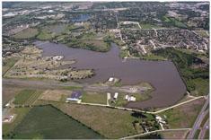
- Lake Clark 0.5 km
- Myrtle Cemetery 2.3 km
- Little Mustang Creek Park 2.4 km
- Bardwell Lake 5.5 km
- ECD Landfill 6.5 km
- Xtream Raceway Park 18 km
- Old Brickyard Golf Course 24 km
- Waste Management Landfill 24 km
- Dallas County, Texas 50 km