Altus Air Force Base (LTS/KLTS ) (Altus, Oklahoma)
USA /
Oklahoma /
Altus /
Altus, Oklahoma
World
/ USA
/ Oklahoma
/ Altus
World / United States / Oklahoma
air force base, United States Air Force
www.altus.af.mil/
www.airnav.com/airport/KLTS
Air Education and Training Command base
97th Air Mobility Wing
54th ARS (KC-135)
55th ARS (KC-135)
56th AS (C-5A)
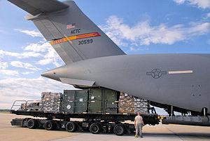
58th AS (C-17)
Runway 17R/35L
Dimensions: 13440 x 150 ft. / 4097 x 46 m
Runway 17L/35R
Dimensions: 9000 x 150 ft. / 2743 x 46 m
Runway 174/354 (Assault Strip)
Dimensions: 3501 x 94 ft. / 1067 x 29 m
www.airnav.com/airport/KLTS
Air Education and Training Command base
97th Air Mobility Wing
54th ARS (KC-135)
55th ARS (KC-135)
56th AS (C-5A)
58th AS (C-17)
Runway 17R/35L
Dimensions: 13440 x 150 ft. / 4097 x 46 m
Runway 17L/35R
Dimensions: 9000 x 150 ft. / 2743 x 46 m
Runway 174/354 (Assault Strip)
Dimensions: 3501 x 94 ft. / 1067 x 29 m
Wikipedia article: http://en.wikipedia.org/wiki/Altus_Air_Force_Base
Nearby cities:
Coordinates: 34°39'51"N 99°16'45"W
- Holloman Air Force Base 662 km
- Kirtland Air Force Base (ABQ/KABQ) 671 km
- Eglin Air Force Base Training Range 1230 km
- Tyndall Air Force Base 1372 km
- Groom Lake (Area 51) 1526 km
- Naval Air Weapons Station China Lake, South Range 1653 km
- Marine Corps Air Station Miramar 1667 km
- Edwards Air Force Base 1721 km
- Vandenberg Air Force Base (VBG/KVBG) 1950 km
- Eielson Air Force Base, AK (EIL/PAEI) 4613 km
- Altus AFB Golf Course 0.6 km
- Base Housing 1.7 km
- Victory, Oklahoma 14 km
- Quartz Mountains 21 km
- Olustee Municipal Airport 22 km
- Prairie Hill, Oklahoma 26 km
- East Duke, Oklahoma 27 km
- Lake Altus-Lugart 29 km
- Blue Summit Wind Energy Center 42 km
- Gould, Oklahoma 45 km