ARSR-4 Air Route Surveillance Radar (QMV)
USA /
California /
Kentfield /
World
/ USA
/ California
/ Kentfield
World / United States / California
military, radar station
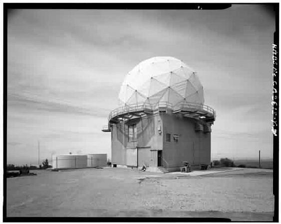
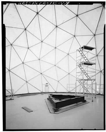
This ARSR-4 radar antenna is housed in the old AN/FPS-26A height-finder (later replaced with an AN/FSS-7 SLBM detection and warning radar) tower.
www.fas.org/nuke/guide/usa/airdef/arsr-4.htm
The Mt Tam site ident is "QMV."
www.fas.org/nuke/guide/usa/airdef/arsr-4.htm
The Mt Tam site ident is "QMV."
Wikipedia article: http://en.wikipedia.org/wiki/ARSR-4
Nearby cities:
Coordinates: 37°55'26"N 122°35'51"W
- Fort Baker 12 km
- Angel Island 14 km
- Treasure Island 22 km
- Hunter's Point Naval Shipyard 29 km
- Drakes Bay Dive Bombing Range 31 km
- Skaggs Island 35 km
- Two Rock U.S. Coast Guard Training Center 41 km
- The Veterans Home of California 56 km
- Naval Auxiliary Air Station, Santa Rosa (site) 58 km
- Gualala Bombing Target (site) 124 km
- Muir Woods National Monument 3.3 km
- Mount Tamalpais State Park 4 km
- Frank Valley 5 km
- Mount Tamalpais Watershed 5.5 km
- Golden Gate Dairy Ranch 6.7 km
- Muir Beach, California 7.1 km
- Daphne Fernwood Cemetery 8.6 km
- Marin City, California 9 km
- Richardson Bay 11 km
- San Francisco Bay 36 km