Emen Canyon
Bulgaria /
Veliko Tarnovo /
Bjala Cherkva /
World
/ Bulgaria
/ Veliko Tarnovo
/ Bjala Cherkva
, 9 km from center (Бяла Черква)
canyon / gorge, interesting place, invisible
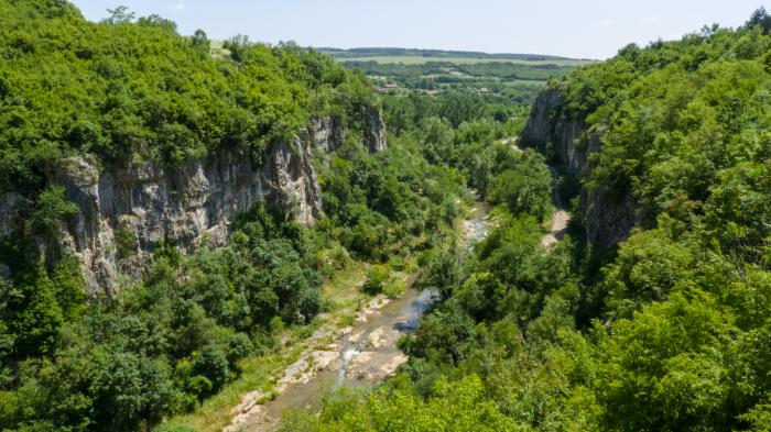
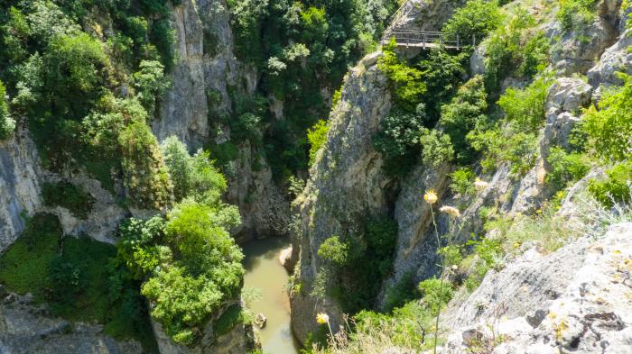
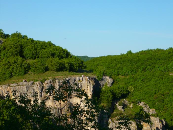
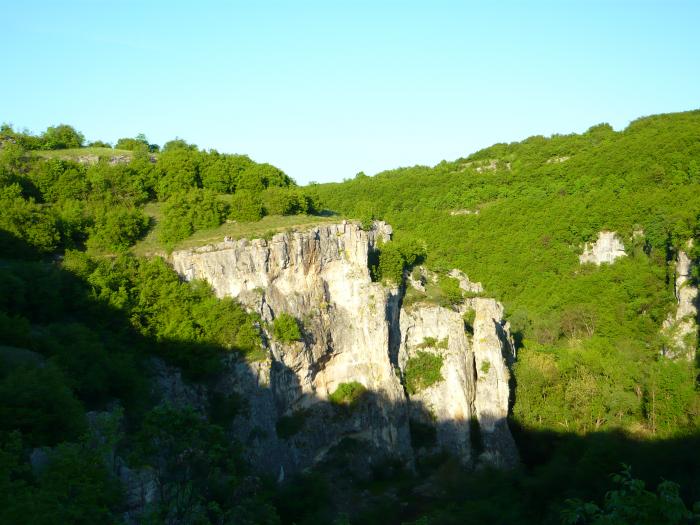
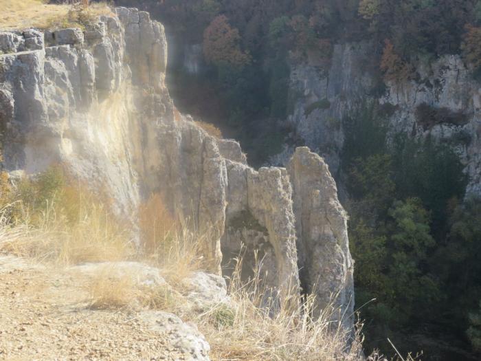
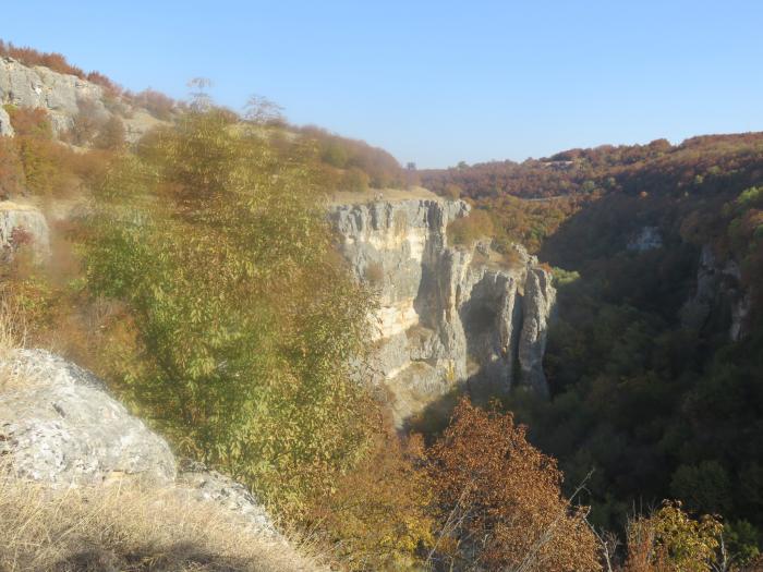
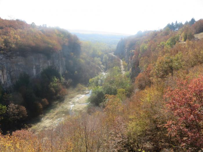
The Emen Canyon is a scenic location along the Negovanka River (a tributary of the Rositsa River), in the foothills of The Central Balkan Range’s northern slope, 20 km from the city of Veliko Tarnovo. The constantly flowing river has cut through the valley’s soft limestone to create many rapids, waterfalls, pools and recesses beneath cliffs that rise as high as 90 meters. The canyon begins to the south of the Novo Selo Village and is interrupted near the village of Emen where the valley slopes rise sharply. For this reason, the canyon is divided into two parts, the Upper and Lower Boaz. Because of its unique natural attributes and beauty, the region has been declared a protected reserve by Decree № 880 on November 11, 1980.
At the beginning of the trail is the Emen Cave. It is 3,113 meters long and occupies a seventeenth place in the list of the deepest caves in Bulgaria.
Bulgaria’s first ecological route was laid out here, called the Negovanka Route, after the river. Bridges were constructed along the route, as were stairs and other wooden structures to make the excursion easier and more pleasant. Without a doubt, the most enjoyable part of the canyon is the secluded waterfall Momin Skok (Girls’ Leap). The falls are 10 meters high and enclosed on three sides by cliffs, with a wide, quiet pool beneath them.
gowhere.bg/en/places/natural-wonders/the-canyon-of-the-...
visitbulgaria.com/the-emen-canyon/
vt-today.com/eco-trail-emen-canyon/
audiotravelguide.ro/en/the-emen-canyon-emen/
kilometri.bg/en/view/emen-canyon
routes.e-tours.bg/en/place/emenski-kanon
-------
Negovanka River Canyon and its surroundings are declared as a natural monument with Ordinance No.880 from 25.11.1980 by the Committee for Environmental Protection at the Council of Ministers.
Area: 25.5 hectares.
bit.ly/3bdgLAv
www.protectedplanet.net/176920
eunis.eea.europa.eu/sites/176920
www.youtube.com/watch?v=OOUfs3cGsIA
Nearby cities:
Coordinates: 43°8'41"N 25°22'9"E
- Kanyona na reka Negovanka (Emenski Canyon) Natural Monument 0.9 km
- Vodopada v mestnostta Kaya Bunar Natural Monument 11 km
- Nicopolis ad Istrum 21 km
- Architectural and Museum Reserve Tsarevets 23 km
- Arbanasi 24 km
- Novae 52 km
- Cherven Archaeological Reserve 75 km
- Rusenski Lom Nature Park 79 km
- Rock-Hewn Churches of Ivanovo 80 km
- Abritus Archaeological Reserve 104 km
- Negovanka Reservoir 0.6 km
- Quarry (near the Vishovgrad - Emen road) 2.7 km
- "Zarapovo” GeoComplex 3.4 km
- Zarapovo Waterfall 3.4 km
- Closed gas station 4.1 km
- Ancient Fortress 5.9 km
- Pavlikeni Municipality 13 km
- Veliko Tarnovo Municipality 22 km
- Gabrovo Province 22 km
- Sevlievo Municipality 29 km