Large enclosure
Syria /
Hhims /
as-Suhnah /
World
/ Syria
/ Hhims
/ as-Suhnah
, 28 km from center (السخنة)
castle, ruins, listed building / architectural heritage
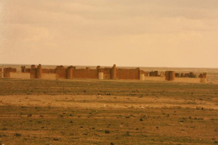
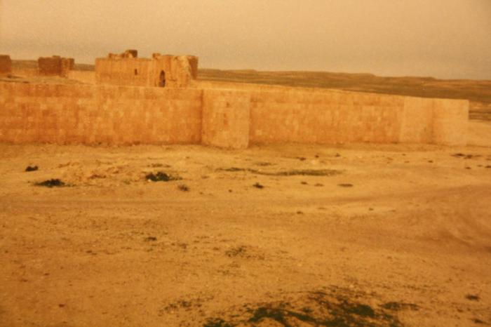


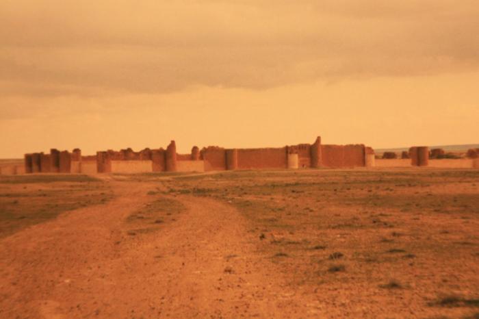

The large enclosure (a squared structure with a 167m side) has an outer structure of stone and reinforced with twenty-eight towers and four entrance gates, one for each facade. Apparently, it was an administrative living center with axial streets connecting four main gates. Within the walls, all arranged around the central courtyard, were located twelve units of the same dimensions but with different plans and functions: the mosque, a “productive” centre with two olive press rooms, an “administrative” centre, six living units and three units (in the corners) apparently without a specific function. A large cistern with an elaborate system of canalizations leading to the region outside the wall was also included in the complex.
The living units of the building share a similar shape and arrangement, with rooms opening to small squared interior courtyards, one for each unit, and/or to the main large courtyard at the center which hosted a water tank. The articulation of the plan suggests that it was also conceived as a transit stop for merchants making their route.
The living units of the building share a similar shape and arrangement, with rooms opening to small squared interior courtyards, one for each unit, and/or to the main large courtyard at the center which hosted a water tank. The articulation of the plan suggests that it was also conceived as a transit stop for merchants making their route.
Nearby cities:
Coordinates: 35°4'26"N 39°4'16"E
- Al-Husn 257 km
- Mardin Fortress 291 km
- Diyarbakir/Amed Citadel 333 km
- Սիս / Sis (Sso Berd) 394 km
- Balahovit Fortress 412 km
- Husn al-Qadisiya (al-Mubarak) Fortress 460 km
- Famagusta Castle and Walls, Surici Neighbourhood 468 km
- Divriği Kalesi 486 km
- Arsuf Stronghold - aka Arsur or Apollonia; a Crusader castle 508 km
- Ancient City of Ercis 575 km
- Qasr al-Hayr al-Sharqi 2.1 km
- Wildlife/game reserve 2.4 km
- Wādī al ‘Adīmah 18 km
- Eastern Dahik mountain 18 km
- Jabal aḑ Ḑāḩik ash Sharqī (475 m) 18 km
- Najib gas field 22 km
- Talat el Krad (357) 24 km
- Al-Sukhnah Subdistrict 58 km
- Markaz Deir ez-Zor Subdistrict 63 km
- Deir ez-Zor Governorate (PCS) 97 km