Discovery Island
Canada /
British Columbia /
Victoria /
World
/ Canada
/ British Columbia
/ Victoria
World / United States / Washington
island
Add category

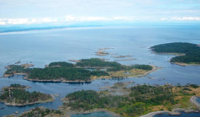
Named after Captain George Vancouver's ship HMS Discovery which, with its armed tender HMS Chatham, charted local waters in 1792, 1793 and 1794.
Wikipedia article: http://en.wikipedia.org/wiki/Discovery_Island_(British_Columbia)
Nearby cities:
Coordinates: 48°25'28"N 123°14'13"W
- San Juan Island 23 km
- Lopez Island 27 km
- Orcas Island 36 km
- Fidalgo Island 41 km
- Lummi Island 52 km
- Camano Island 54 km
- Saltspring Island 64 km
- Bainbridge Island 92 km
- Vashon Island 114 km
- Sauvie Island 287 km
- Plumper Passage 1.5 km
- Baynes Channel 2.9 km
- Ten Mile Point 4.7 km
- Cadboro Bay 5.1 km
- Uplands 5.4 km
- South Oak Bay 5.5 km
- North Oak Bay 5.7 km
- Henderson 6 km
- Cadboro Bay 6.1 km
- University of Victoria 6.9 km