Yardley (Birmingham)
United Kingdom /
England /
Solihull /
Birmingham
World
/ United Kingdom
/ England
/ Solihull
World / United Kingdom / England
draw only border, parliamantary constituency (UK)
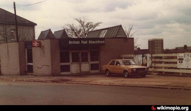
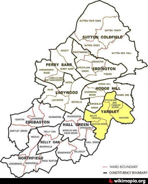
Birmingham, Yardley is a constituency represented in the House of Commons of the Parliament of the United Kingdom. The constituency was created in 1983, partially replacing the earlier Birmingham Stechford constituency, the town of Strechford itself being located in the northern part of the constituency. It is now also a constituency district within the administrative structure of Birmingham City Council, with its own district committee. It comprises the four electoral wards of Stechford & Yardley North, South Yardley, Sheldon and Acocks Green (see outline map above). Councillors from these wards sit on the district committee.
Yardley is not a town. Yardley is named in the Domesday Book and was referred to as early as 972 in King Edgar's Charter where it is named Gyrdleah. It was mentioned as being under the possession of Pershore Abbey. The parish of Yardley, historically considered part of Worcestershire, became the only parish in the Yardley Rural District under the Local Government Act 1894, and was added to Birmingham and Warwickshire in 1911. The ancient parish of Yardley included the areas known as Stechford and Hall Green. The area of Gilbertstone straddles the border of Yardley and South Yardley.
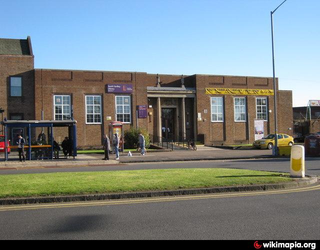
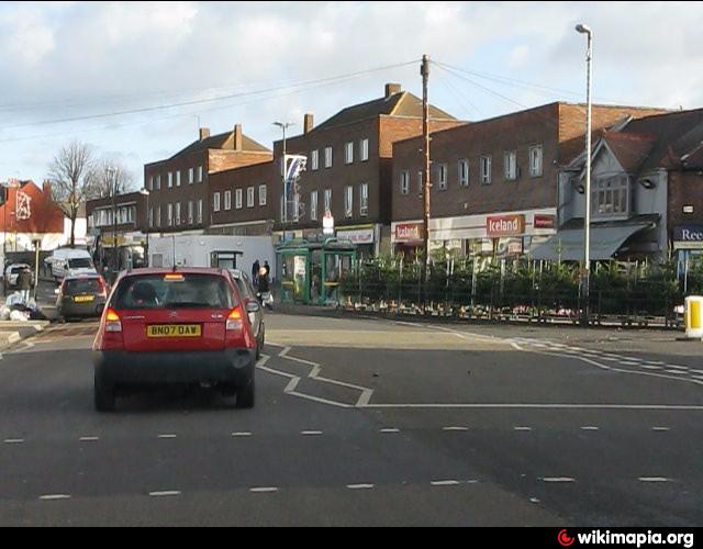
Communities and neighbourhoods (in whole or in part) within the district include: Stechford, Lea Hall, Garret's Green, Lyndon Green, Sheldon, Gilbertstone, South Yardle, Acocks Green, Tyseley, Hay Mills, and Small Heath.
for more on the History of the Yardley district see @:
www.birmingham.gov.uk/historyofyardley
for large-scale online detailed downloadable map from Birmingham C.C. used in drawing attached polygon @:
localview.birmingham.gov.uk/My_Local_Information/Sites/...
Yardley is not a town. Yardley is named in the Domesday Book and was referred to as early as 972 in King Edgar's Charter where it is named Gyrdleah. It was mentioned as being under the possession of Pershore Abbey. The parish of Yardley, historically considered part of Worcestershire, became the only parish in the Yardley Rural District under the Local Government Act 1894, and was added to Birmingham and Warwickshire in 1911. The ancient parish of Yardley included the areas known as Stechford and Hall Green. The area of Gilbertstone straddles the border of Yardley and South Yardley.
Communities and neighbourhoods (in whole or in part) within the district include: Stechford, Lea Hall, Garret's Green, Lyndon Green, Sheldon, Gilbertstone, South Yardle, Acocks Green, Tyseley, Hay Mills, and Small Heath.
for more on the History of the Yardley district see @:
www.birmingham.gov.uk/historyofyardley
for large-scale online detailed downloadable map from Birmingham C.C. used in drawing attached polygon @:
localview.birmingham.gov.uk/My_Local_Information/Sites/...
Wikipedia article: http://en.wikipedia.org/wiki/Yardley,_Birmingham
Nearby cities:
Coordinates: 52°27'39"N 1°48'31"W
- Solihull 4.1 km
- Hodge Hill 6.6 km
- Ladywood 12 km
- Perry Barr 15 km
- Sutton Coldfield 17 km
- Aldridge 24 km
- Aylesbury 95 km
- High Wycombe 113 km
- Wigan 140 km
- Ashford 232 km
- Yardley Cemetery 0.5 km
- Hay Hall Industrial Estate 1.7 km
- Hay Barn Recreation Ground 1.8 km
- Heartlands Hospital 2.3 km
- Stechford 2.8 km
- Hodge Hill 2.9 km
- Hall Green 4.7 km
- Solihull (Metropolitan Borough) 6.2 km
- Ladywood 6.8 km
- Warwickshire 24 km