Ladywood (Birmingham)
United Kingdom /
England /
Birmingham
World
/ United Kingdom
/ England
/ Birmingham
World / United Kingdom / England
draw only border, parliamantary constituency (UK)


Ladywood is an inner-city area in the City of Birmingham, England. It is a council constituency, managed by its own district committee as well as a UK Parliamentary Constituency. The constituency includes the smaller Ladywood ward together with the neighbouring wards of Aston, Nechells and Soho. In June 2004, Birmingham City Council conducted a city-wide "Ward Boundary Revision" to round-up the thirty-nine Birmingham wards to fourty. As a result of this, Ladywood's boundaries were expanded to include the whole of the Birmingham City Centre.
At the time of the 2001 Population Census, 23,789 people were living in Ladywood. The population density was 3,330 people per km² living within its 7.1 km² boundary, compared with 3,649 people per km² for Birmingham. Nearly half of the population of Ladywood (49%) consists of ethnic minorities compared with 29.6% for Birmingham in general.
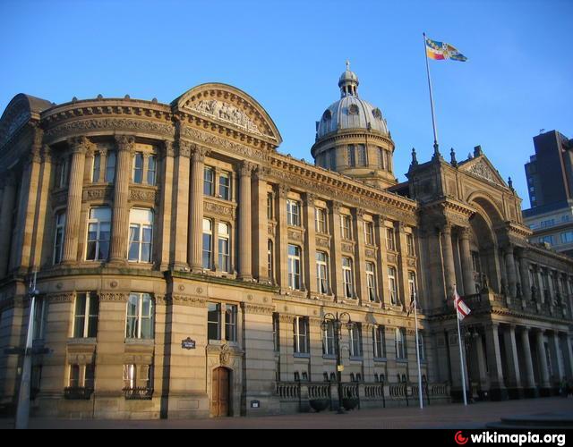
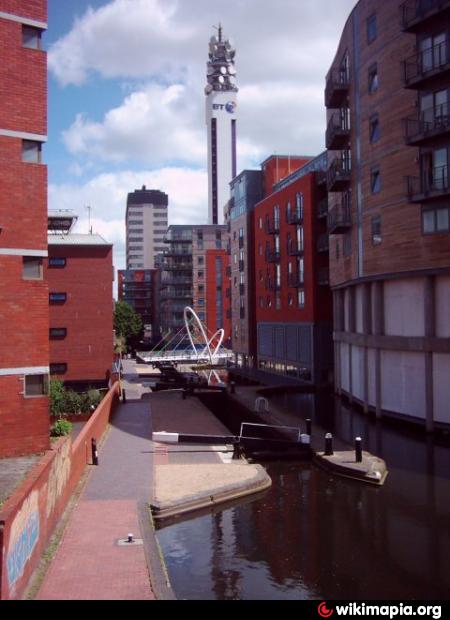
The Ladywood ward combines areas of varying land-use, such that no generalisation is possible. There is the city centre (the economically valuable Central business district), the affluent Jewellery Quarter, and Broad Street areas which have become fashionable for "luxury apartment" living, the Lee Bank area (now known as Park Central) which has been fully redeveloped, and there is the remainder of the ward which is relatively economically impoverished. Most of this (and the area now occupied by Park Central) was redeveloped during the 1960s, with decaying terraced slums being cleared to make way for new low-rise housing and high-rise flats. Although the newer homes were an improvement on their predecessors in terms of quality and sanitation, social problems of tower blocks resulted in much of the local area having issues with car crime, drug dealing, anti-social behaviour and many of the other problems commonly associated with inner city areas across England.
Neighbourhoods and communities within the district include : Winson Green, Hockley, Gib Heath, Aston, Newton, Nechells, Vauxhall, Duddeston, Bordesley, Small Heath, Digbeth, High Gate, Soho and within the City Centre itself the Jewellrey & Gun Quarters.
for more on the history of Ladywood see @:
www.birmingham.gov.uk/ladywoodhistory
for Birmingham C.C. detailed large scale on-line map used in drawing attached polygon see @: localview.birmingham.gov.uk/My_Local_Information/Sites/...
At the time of the 2001 Population Census, 23,789 people were living in Ladywood. The population density was 3,330 people per km² living within its 7.1 km² boundary, compared with 3,649 people per km² for Birmingham. Nearly half of the population of Ladywood (49%) consists of ethnic minorities compared with 29.6% for Birmingham in general.
The Ladywood ward combines areas of varying land-use, such that no generalisation is possible. There is the city centre (the economically valuable Central business district), the affluent Jewellery Quarter, and Broad Street areas which have become fashionable for "luxury apartment" living, the Lee Bank area (now known as Park Central) which has been fully redeveloped, and there is the remainder of the ward which is relatively economically impoverished. Most of this (and the area now occupied by Park Central) was redeveloped during the 1960s, with decaying terraced slums being cleared to make way for new low-rise housing and high-rise flats. Although the newer homes were an improvement on their predecessors in terms of quality and sanitation, social problems of tower blocks resulted in much of the local area having issues with car crime, drug dealing, anti-social behaviour and many of the other problems commonly associated with inner city areas across England.
Neighbourhoods and communities within the district include : Winson Green, Hockley, Gib Heath, Aston, Newton, Nechells, Vauxhall, Duddeston, Bordesley, Small Heath, Digbeth, High Gate, Soho and within the City Centre itself the Jewellrey & Gun Quarters.
for more on the history of Ladywood see @:
www.birmingham.gov.uk/ladywoodhistory
for Birmingham C.C. detailed large scale on-line map used in drawing attached polygon see @: localview.birmingham.gov.uk/My_Local_Information/Sites/...
Wikipedia article: http://en.wikipedia.org/wiki/Ladywood
Nearby cities:
Coordinates: 52°29'23"N 1°53'49"W
- Yardley 2.4 km
- Hodge Hill 3 km
- Solihull 4 km
- Perry Barr 9 km
- Sutton Coldfield 13 km
- Aldridge 18 km
- Aylesbury 101 km
- High Wycombe 119 km
- Wigan 134 km
- Ashford 239 km
- Birmingham Children's Hospital 0.6 km
- Aston Royal Mail Delivery Office 0.7 km
- New John Street Park 0.8 km
- Masshouse Circus 1 km
- Birmingham Curzon Street Station (under construction) 1.2 km
- Birmingham City Centre 1.3 km
- Lozells 1.5 km
- Aston 1.6 km
- Perry Barr 4.5 km
- Edgbaston 6.1 km