Gamla
Israel /
Hazafon /
Tuba-Zangariyye /
World
/ Israel
/ Hazafon
/ Tuba-Zangariyye
World / Israel
ruins, archaeological site, fortification, nature conservation park / area, interesting place

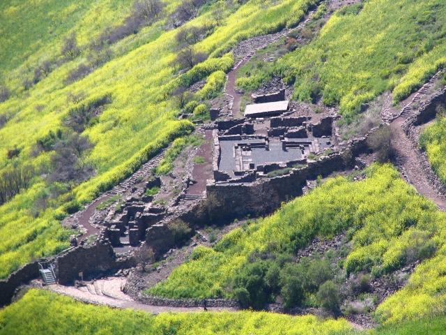
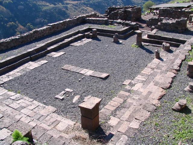
www.biblewalks.com/Sites/Gamla.html National park, nature reserve and archaeological site. Ruins of a mountain-top town besieged and destroyed in 67 AD, during the first Jewish revolt against the Romans; the campaign is described in some detail by Flavius Josephus in his Jewish Wars (4:1-83). The extensive remains here include an impressive oil press facility plus one of the few synagogues known from the 1st century.
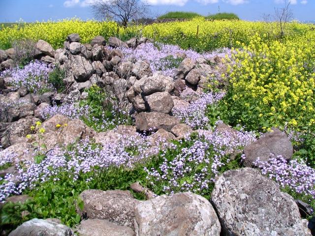
The mountain's name derives from its shape resembling a camel's hump. Also of interest at Gamla: ancient dolmens, remains of a Byzantine town, a waterfall, spring wildflowers, and the nesting areas of vultures and raptors.
The ruins of Gamla, named after the profile of the hill which looks like a humpback camel. The city clings to a steep south facing slope and was protected at the east end by a fortified wall which was repaired and extended in the first century AD during the First Jewish Revolt against Rome. This was the scene of a siege by Roman troops in 67AD which resulted in the massacre of almost the entire population. The siege is vividly described in Josephus's "The Jewish War". The site was excavated between 1976 and 1989 and is now partially restored and open to visitors
Wikipedia article: http://en.wikipedia.org/wiki/Gamla
Nearby cities:
Coordinates: 32°54'10"N 35°44'36"E
- Umm Qeis 28 km
- Beit Ras - Capitolias 32 km
- زور الهنداوي 32 km
- Mount Tabor 42 km
- Old City 50 km
- Golan Heights 50 km
- Gerasa 70 km
- Walled perimeter of Ancient Jerash 70 km
- Bosra's Historic Quarter 81 km
- Jabal Al-Qal'a 107 km
- Military Zone 2.2 km
- Military Zone 3.4 km
- Military Zone 4.4 km
- Military Zone 7.2 km
- Golan Plateau 11 km
- Military Zone 13 km
- UNDOF Zone 22 km
- Quneitra Governorate (PCS) 27 km
- Daraa Governorate (PCS) 39 km
- Horan Plain 40 km