Penang Bridge
Malaysia /
Pulau Pinang /
Perai /
World
/ Malaysia
/ Pulau Pinang
/ Perai
World / Malaysia / Perak
toll bridge
Add category
www.penangbridge.com.my
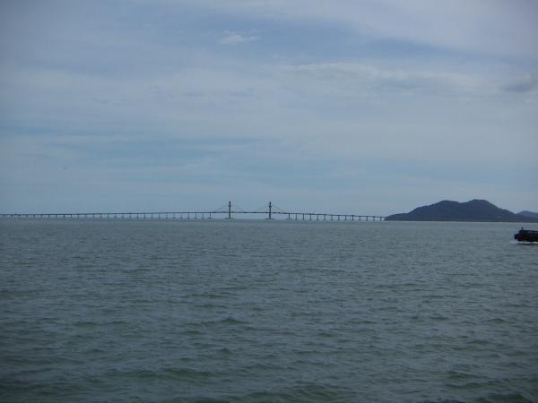
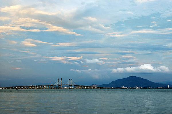
The Penang Bridge (Jambatan Pulau Pinang in Malay) is a dual-carriageway toll bridge that connects Gelugor on the island of Penang and Seberang Prai on the mainland of Malaysia on the Malay Peninsula. The bridge is also linked to the North-South Expressway in Prai and Jelutong Expressway in Penang. It was officially opened to traffic on September 14, 1985. The total length of the bridge is 13.5 km, making it among the longest bridges in the world as well as a national landmark.
Bridge specifications
Overall Length: 13.5 km (8.4 miles)
Length Over Water: 8.4 km (5.2 miles)
Penang Island Viaduct & Approach: 1.5 km (0.9 miles)
Prai Approach: 3.6 km (2.2 miles)
Carriageway: 2 lanes per carriageway except in the central span where it is 3. Work to widen the entire bridge to 3 lanes per carriageway has begun.
Height of Tower Above Water: 101.5 m
Height of Bridge Above Water: 33 m
Main Span: 225 m
End Span: 107.5 m
Other Span: 40 m
Speed limit: 80 km/h
To monitor traffic flow and Bridge security, a 24-hour closed circuit television (CCTV) camera installed at 8 locations along the laybys and main span. The CCTV cameras are connected to the Penang Bridge Communication Centre to enhance traffic monitoring surveillance service for further improvement and to enhance response time to serve users in time of incident or congestion.
Wikipedia article: http://en.wikipedia.org/wiki/Penang_Bridge
Nearby cities:
Coordinates: 5°21'18"N 100°21'14"E
- Akashi Kaikyo Bridge 4828 km
- The East Bridge 9488 km
- The Great Belt Fixed Link 9497 km
- Richmond-San Rafael Bridge 13494 km
- San Francisco-Oakland Bay Bridge 13509 km
- Bay Bridge (New Eastern Section) 13511 km
- San Mateo-Hayward Bridge 13532 km
- Confederation Bridge 14083 km
- Sault Ste. Marie International Bridge 14244 km
- Thomas J. Hatem Memorial Bridge 15023 km
- Penang 1 km
- Perai Free Industrial Zone 5.3 km
- Bandar Sri Pinang 5.4 km
- Butterworth Central Business District 5.4 km
- Perai 5.6 km
- Jelutong 5.7 km
- Sungai Pinang 6.4 km
- Butterworth 7.8 km
- Coastal waters of Penang island 10 km
- Penang Island 10 km
Comments