San Mateo-Hayward Bridge
| road bridge, toll bridge
USA /
California /
Foster City /
World
/ USA
/ California
/ Foster City
World / United States / California
road bridge, toll bridge

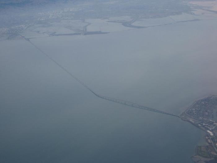

The San Mateo-Hayward Bridge links the San Francisco Peninsula with the East Bay.
The original bridge built in 1929. It was the longest bridge in the world.
Replaced in 1967.
Total length of bridge is 7 miles (11.3 Km). Multiple steel girder spans make up the "highrise," measuring 1.9 of the total 7 miles. The rest of the bridge is the trestle portion.
Toll is collected on west bound traffic only. FasTrak accepted.
Wikipedia article: http://en.wikipedia.org/wiki/San_Mateo-Hayward_Bridge
Nearby cities:
Coordinates: 37°35'42"N 122°12'32"W
- Bay Bridge (New Eastern Section) 29 km
- San Francisco-Oakland Bay Bridge 30 km
- Richmond-San Rafael Bridge 46 km
- Sault Ste. Marie International Bridge 3246 km
- Thomas J. Hatem Memorial Bridge 3974 km
- Confederation Bridge 4819 km
- Akashi Kaikyo Bridge 8718 km
- The Great Belt Fixed Link 8773 km
- The East Bridge 8777 km
- Penang Bridge 13539 km
- Poplar Creek Golf Course 10 km
- Coyote Point Recreation Area 10 km
- Tony Lema Course 11 km
- Oyster Bay Regional Shoreline 13 km
- Metropolitan Golf Links 14 km
- San Francisco Bay Oakland International Airport 14 km
- San Francisco Bay 15 km
- SFPUC Peninsula Watershed 16 km
- EBMUD San Leandro Watershed 22 km
- San Andreas Fault Zone 85 km