Mahim Fort (Mumbai)
India /
Maharashtra /
Mumbai
World
/ India
/ Maharashtra
/ Mumbai
World / India / Maharashtra / Greater Bombay
fortification, historic landmark
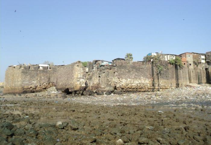
The fort lies off the Mahim Causeway which links the suburbs to the city. The fort is heavily encroached by slums, and parts of the fort have caved in due to tidal erosion and neglect. Though the site is classified as a Grade I heritage structure, nothing much has been done to maintain it (en.wikipedia.org/wiki/Mahim_Fort#cite_note-express-1)
Wikipedia article: http://en.wikipedia.org/wiki/Mahim_Fort
Nearby cities:
Coordinates: 19°2'31"N 72°50'17"E
- Dronagiri 21 km
- Vasai Fort 33 km
- Karnala Fort 34 km
- Kila Pagar 51 km
- Tandulwadi Fort 65 km
- Avchitgad Fort 68 km
- Asherigad 88 km
- Gambhirgad 115 km
- DANTI PROTECTION WALL 224 km
- Old town 296 km
- Thote Garden 0.9 km
- Bombay Scottish School 0.9 km
- Mahim 0.9 km
- R.B.I colony 1.1 km
- Kataria Colony 1.2 km
- Mahim Bay 1.5 km
- Bandra 1.6 km
- Shivaji Park Residential Zone 1.8 km
- Dadar 2.6 km
- Mumbai Suburban District 11 km
Comments