Polyarny, Chukotka Autonomous Okrug
Russia /
Chukotka /
Leningradskiy /
World
/ Russia
/ Chukotka
/ Leningradskiy
, 40 km from center (Ленинградский)
World / Russia / Chukot
ghost town
Add category
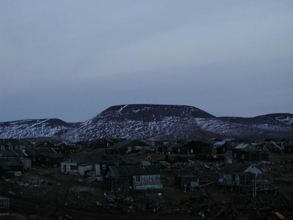
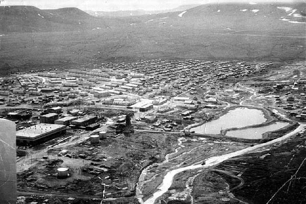
Polyarny (Russian: Полярный) was an urban locality (an urban-type settlement) in Shmidtovsky District (now merged into Iultinsky District of Chukotka Autonomous Okrug, Russia, about 90 kilometers (56 mi) west of Mys Shmidta.Population: 0 (2002 Census);4,678 (1989 Census).
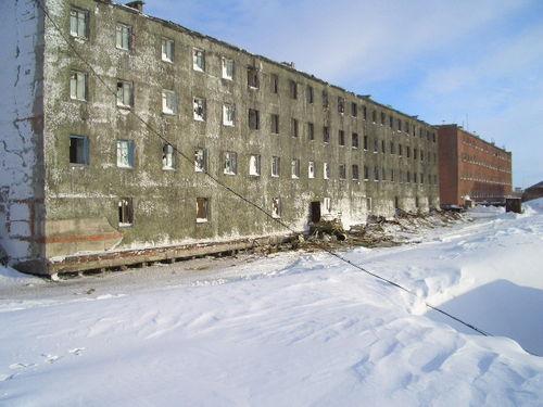
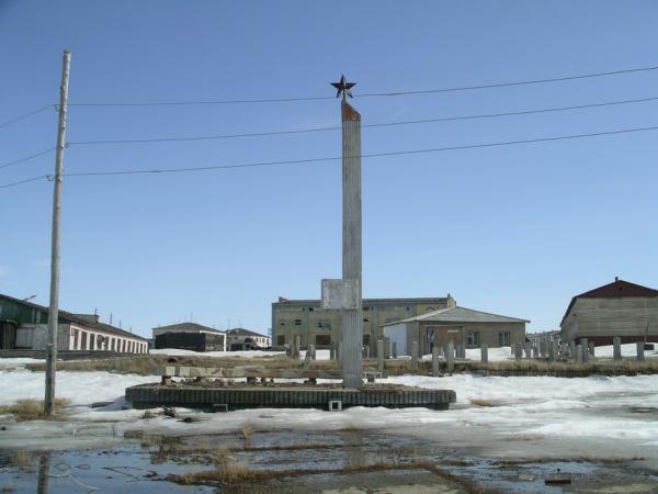
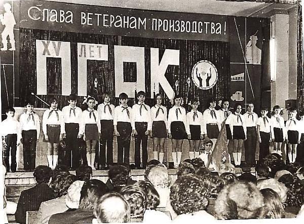
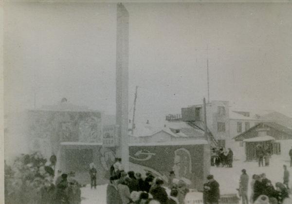
The settlement was specifically established to house miners working in the nearby goldmines.In 1961, geologists working in the Pilkhinkuul river valley found a large gold deposit. On March 26, 1963 decree number 104 of the Northeastern Economic Council announced an official decision on the creation of a mine to be named "Polyarny" and a camp of the same name. The first convoy of 15 tractors brought equipment, building materials and everything needed to create the mine and the village. Despite the difficult conditions construction was rapid. The settlement was constructed in three locations: in the centre two-storeyed well-appointed homes and general social infrastructure were built. On the southern outskirts of the settlement, a more private sector was constructed, which became commonly known as "Shanghai" (Russian: Шанхай). This was also the site of a number of wooden houses with few amenities. Finally, in the northern part of the settlement production units were constructed along with a small residential area, which became known as "Bichgrad" (Russian: Бичгра́д), mostly consisting of single-story barracks. Because of its relative remoteness from the main part of the settlement a bus route was organised to the high school in 1975. In the north-eastern part of the village was a base of geologists with the residential area, which was known colloquially as "Exploration" (Russian: Разведка). At the end of the 1980s additional construction of residential buildings began, where people began to move from deplorable housing, where they had been living without repair since the foundation of the settlement. In accordance with the direction of the prevailing wind almost all the houses were oriented from east to west when they were constructed, and because of the permafrost layer, strong foundations were laid and no construction was undertaken higher than two storeys.
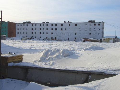
When mining became unprofitable, a law was passed in May 1995, abolishing the settlement; it was abolished in 1995. Polyarny had a population of around four thousand during the 1980s, but once the mines were closed and the village liquidated, it became a ghost town.
The settlement was specifically established to house miners working in the nearby goldmines.In 1961, geologists working in the Pilkhinkuul river valley found a large gold deposit. On March 26, 1963 decree number 104 of the Northeastern Economic Council announced an official decision on the creation of a mine to be named "Polyarny" and a camp of the same name. The first convoy of 15 tractors brought equipment, building materials and everything needed to create the mine and the village. Despite the difficult conditions construction was rapid. The settlement was constructed in three locations: in the centre two-storeyed well-appointed homes and general social infrastructure were built. On the southern outskirts of the settlement, a more private sector was constructed, which became commonly known as "Shanghai" (Russian: Шанхай). This was also the site of a number of wooden houses with few amenities. Finally, in the northern part of the settlement production units were constructed along with a small residential area, which became known as "Bichgrad" (Russian: Бичгра́д), mostly consisting of single-story barracks. Because of its relative remoteness from the main part of the settlement a bus route was organised to the high school in 1975. In the north-eastern part of the village was a base of geologists with the residential area, which was known colloquially as "Exploration" (Russian: Разведка). At the end of the 1980s additional construction of residential buildings began, where people began to move from deplorable housing, where they had been living without repair since the foundation of the settlement. In accordance with the direction of the prevailing wind almost all the houses were oriented from east to west when they were constructed, and because of the permafrost layer, strong foundations were laid and no construction was undertaken higher than two storeys.
When mining became unprofitable, a law was passed in May 1995, abolishing the settlement; it was abolished in 1995. Polyarny had a population of around four thousand during the 1980s, but once the mines were closed and the village liquidated, it became a ghost town.
Wikipedia article: http://en.wikipedia.org/wiki/Polyarny,_Chukotka_Autonomous_Okrug
Nearby cities:
Coordinates: 69°9'55"N 178°42'51"E
- Leningradsky, Chukotka Autonomous Okrug 26 km
- Комсомольский 238 km
- Polyana Tract 261 km
- Zapadniy 322 km
- Valkumey (abandoned) 339 km
- Стадухино 551 km
- Mikhalkino 675 km
- Petushki 681 km
- Nordvik 2289 km
- Separate storage item (OLP) «Rubak» in the composition of Norilsky ITL GULAG. The most northerly island GULAG! 2370 km
- Cape Billings 129 km
- Pegtymel petroglyphs 175 km