Jamalpur District Town
| town district
Bangladesh /
Jamalpur /
World
/ Bangladesh
/ Jamalpur
/ Jamalpur
World / Bangladesh / Dhaka / Jamalpur / Jamalpur
town district
Add category
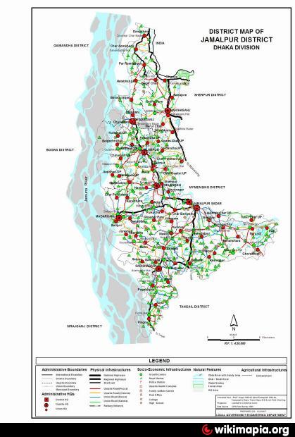
Jamalpur District (dhaka division) with an area of 2031.98 sq km, is bounded by Meghalaya State of India, kurigram and sherpur districts on the north, tangail district on the south, mymensingh and Sherpur districts on the east, jamuna river, bogra, sirajganj and gaibandha districts on the west. Annual average temperature maximum 33.3°C, minimum 12°C; annual rainfall 2174 mm. Main rivers are Jamuna, old brahmaputra, Jhenai, Banar, Jirjira, Chhatal.
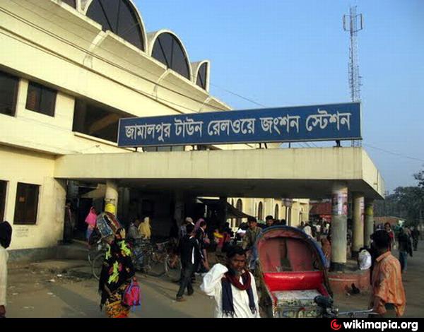
Jamalpur (Town) consists of 12 wards and 80 mahallas. The municipality was established in 1869. The area of the town is 53.28 sq km. The town has a population of 116754; male 51.06%, female 48.94%. Density of population is 2191 per sq km. Literacy rate among the town people is 43.60%. It has a railway junction and three dakbungalows.
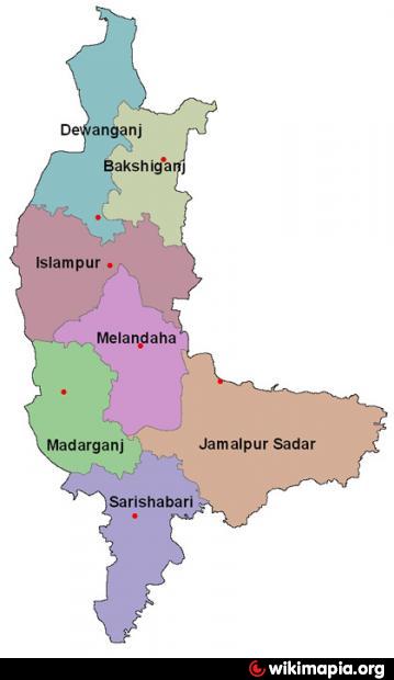
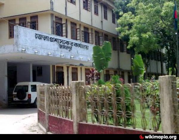
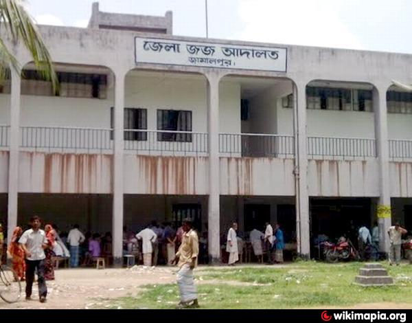
Administration: Jamalpur district was established in 1978. The district consists of 7 upazilas, 6 municipalities, 68 union parishads, 57 wards, 224 mahallas and 1532 villages. The upazilas are jamalpur sadar, bakshiganj, dewanganj, islampur, madarganj, melandaha and sarishabari. The municipalities are Jamalpur Sadar, Sarishabari, Melandaha, Madarganj, Islampur and Dewanganj.
Archaeological heritage and relics: Tomb of Shah Jamal, tomb of Shah Kamal, five domed Raspal Jame Mosque at Sarishabari (nineteenth century), Narapara Fort at Sarishabari (sixteenth century).
Historical events: Fakir Sannyasi Rebellion (1772-1790), Indigo Resistance Movement (1829), famine (1874) and construction of rail way (1899).
Population 2089366; male 50.58%, female 49.42%; Muslim 97.74%, Hindu 1.98%, Christian 0.10%, Buddhist 0.04% and others 0.14%; ethnic nationals: Garo, Hodi, Kurmi and Mal.
Religious institutions: Mosque 3340, temple 47, church 39, tomb 13, most noted which are Shailerkandha Jame Mosque, Gaouripur Kachari Jame Mosque, tomb of Shah Jamal, dargah of Shah Kamal and Dayamayee Mondir.
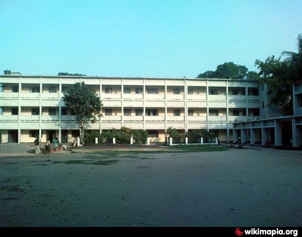
Literacy and educational institutions: Average literacy 21.5%; male 26.6% and female 16%. Educational institutions: government college 5, non-government college 20, government secondary school 7, non-government secondary school 224, madrasa 113, junior high school 38, government primary school 588, non-government primary school 390, kinder garden school 13, law college 1, homeopathy college 1, agricultural research centre 1. Noted institutions: Ashek Mahmud Degree College, Jamalpur Zila School, Singhajani Girl's High School, Nandina Pilot High School, Pingna Madrasa in Sarishabari (Emperor Shahjahan's period), Pingna English High School (1896), Sarishabari Nidmoni Model High School (1920), Balridia Primary School (1869), Pogaldigha Primary School (1890), Hazrabari High School (1926).
Cultural organisations: Club 139, public library 2, cinema hall 18, stadium 1, public hall 1, upazila auditorium 6, orphanage 448, literary society 4, women's organisation 5, theatre group 6, Shilpakala Academy 1.
Main occupations: Agriculture 44.01%, transport 1.39%, fishing 1.26%, agricultural labourer 24.6%, wage labourer 2.86%, commerce 10.62%, service 4.84% and others 10.42%.
Land use: Total cultivable land 186058.87 hectares; single crop 19.57%, double crop 70.29% and treble crop 10.14%; land under irrigation 29%.
Main crops Paddy, jute, sugarcane, mustard seed, peanut, wheat, sweet potato, tobacco, betel leaf, chilly, pulse and vegetables.
Fisheries, dairies, poultries Fishery 51, dairy 379, poultry 899.
Communication facilities Roads: pucca 772.67 km, semi pucca 120.55 km, mud road 3374.90 km; railways 108.50 km; waterways 68 nautical mile.
NGO activities: Operationally important NGOs are brac, asa, proshika, caritas, World Vision, Gonoshahajjo Sangstha, adab and Sara.
Health centres: General hospital 1, upazila health complex 6, family welfare centre 39, rail way hospital 2, TB clinic, union health centre 28 and leprosy clinic 7.
Jamalpur (Town) consists of 12 wards and 80 mahallas. The municipality was established in 1869. The area of the town is 53.28 sq km. The town has a population of 116754; male 51.06%, female 48.94%. Density of population is 2191 per sq km. Literacy rate among the town people is 43.60%. It has a railway junction and three dakbungalows.
Administration: Jamalpur district was established in 1978. The district consists of 7 upazilas, 6 municipalities, 68 union parishads, 57 wards, 224 mahallas and 1532 villages. The upazilas are jamalpur sadar, bakshiganj, dewanganj, islampur, madarganj, melandaha and sarishabari. The municipalities are Jamalpur Sadar, Sarishabari, Melandaha, Madarganj, Islampur and Dewanganj.
Archaeological heritage and relics: Tomb of Shah Jamal, tomb of Shah Kamal, five domed Raspal Jame Mosque at Sarishabari (nineteenth century), Narapara Fort at Sarishabari (sixteenth century).
Historical events: Fakir Sannyasi Rebellion (1772-1790), Indigo Resistance Movement (1829), famine (1874) and construction of rail way (1899).
Population 2089366; male 50.58%, female 49.42%; Muslim 97.74%, Hindu 1.98%, Christian 0.10%, Buddhist 0.04% and others 0.14%; ethnic nationals: Garo, Hodi, Kurmi and Mal.
Religious institutions: Mosque 3340, temple 47, church 39, tomb 13, most noted which are Shailerkandha Jame Mosque, Gaouripur Kachari Jame Mosque, tomb of Shah Jamal, dargah of Shah Kamal and Dayamayee Mondir.
Literacy and educational institutions: Average literacy 21.5%; male 26.6% and female 16%. Educational institutions: government college 5, non-government college 20, government secondary school 7, non-government secondary school 224, madrasa 113, junior high school 38, government primary school 588, non-government primary school 390, kinder garden school 13, law college 1, homeopathy college 1, agricultural research centre 1. Noted institutions: Ashek Mahmud Degree College, Jamalpur Zila School, Singhajani Girl's High School, Nandina Pilot High School, Pingna Madrasa in Sarishabari (Emperor Shahjahan's period), Pingna English High School (1896), Sarishabari Nidmoni Model High School (1920), Balridia Primary School (1869), Pogaldigha Primary School (1890), Hazrabari High School (1926).
Cultural organisations: Club 139, public library 2, cinema hall 18, stadium 1, public hall 1, upazila auditorium 6, orphanage 448, literary society 4, women's organisation 5, theatre group 6, Shilpakala Academy 1.
Main occupations: Agriculture 44.01%, transport 1.39%, fishing 1.26%, agricultural labourer 24.6%, wage labourer 2.86%, commerce 10.62%, service 4.84% and others 10.42%.
Land use: Total cultivable land 186058.87 hectares; single crop 19.57%, double crop 70.29% and treble crop 10.14%; land under irrigation 29%.
Main crops Paddy, jute, sugarcane, mustard seed, peanut, wheat, sweet potato, tobacco, betel leaf, chilly, pulse and vegetables.
Fisheries, dairies, poultries Fishery 51, dairy 379, poultry 899.
Communication facilities Roads: pucca 772.67 km, semi pucca 120.55 km, mud road 3374.90 km; railways 108.50 km; waterways 68 nautical mile.
NGO activities: Operationally important NGOs are brac, asa, proshika, caritas, World Vision, Gonoshahajjo Sangstha, adab and Sara.
Health centres: General hospital 1, upazila health complex 6, family welfare centre 39, rail way hospital 2, TB clinic, union health centre 28 and leprosy clinic 7.
Nearby cities:
Coordinates: 24°54'46"N 89°56'22"E
- Naogaon District Town 107 km
- Dinajpur District Town 160 km
- Chuadanga District Town 178 km
- Jashore District Town 206 km
- Bagerhat District 247 km
- Zianagar Upazila 264 km
- Kharagpur 396 km
- Bhadohi 749 km
- Shumali Lahore (North Lahore) 1702 km
- Mirpur 1828 km
- Melandaha Upazila HQ 13 km
- Madarganj Upazila HQ 23 km
- The Largest Boisha Beel, Edited by Jubair, Dhaka University.24-05-2015 23 km
- Islampur Upazila HQ 24 km
- Sherpur District 25 km
- Jamalpur District 26 km
- Dewanganj Upazila HQ 33 km
- Gaibandha District 71 km
- Dhaka Division 95 km
- Rajshahi Division 105 km
Comments