Chuadanga District Town
Bangladesh /
Chuadanga /
World
/ Bangladesh
/ Chuadanga
/ Chuadanga
World / Bangladesh / Khulna / Kushtia / Choua Danga
city, third-level administrative division, town district
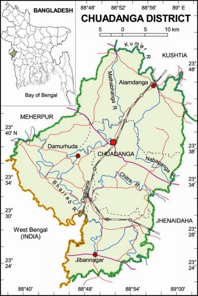
Chuadanga District (khulna division) with an area of 1157.42 sq km, is bounded by kushtia district on the northeast, meherpur district on the northwest, Jhenaidah district on the south and southeast, Nadia district of west bengal of India on the southwest. Annual average temperature maximum 37.1°C, minimum 11.2°C; annual rainfall 1467 mm. Chaudanga region is within the Gangetic delta. Main rivers are Mathabhanga, bhairab, kumar, Chitra, and nabaganga.
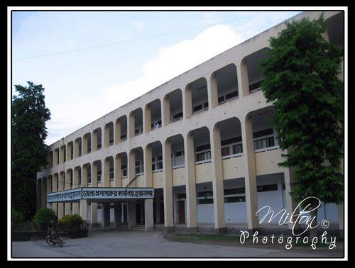
Chuadanga (Town) stands on the bank of the river Mathabhanga. It consists of 9 wards and 41 mahallas. It is a municipal town, though established in 1960, it started functioning in 1965. The town has an area of 36.12 sq km. It has a population of 72081; male 50.13%, female 49.87%. Literacy rate among the town people is 48%.
Administration: Chuadanga sub-division was within Nadia district before the Partition. In 1947, excepting Krishnagar thana, the whole territory of Chuadanga sub-division was included in Kushtia district. It was turned into a district in 1984. The district consists of 4 municipalities, 36 wards, 93 mahallas, 4 upazilas, 31 union parishads, 421 mouzas and 514 villages. The upazilas are chuadanga sadar, alamdanga, damurhuda, jibannagar. Municipalities are Chuadanga Sadar, Alamdanga, Damurhuda and Jibannagar
Archaeological heritage and relics: Three domed Chuadanga Bara Mosque, Gholdari Mosque (1006 AD), Thakurpur Mosque, Shibnagar Mosque, Jamjami Mosque, Hazar Duari School (Damurhuda), Karpasdanga Neelkuthi, Gholdari Neelkuthi.
Historical events: It is supposed from the records of the Greek historians and geographical formations that this region was a part of the kingdom of Gangaridhi and there was a city called Gangey here. From the beginning of the British rule the people of Chuadanga participated in many uprisings and democratic movements. Their contributions to uprisings and movements including the wahabi movement (1831), faraizi movement (1838-47), sepoy revolt (1857), Indigo Rebellion (1859-60), khilafat movement (1920), swadeshi movement (1906), Non cooperation, Violation of Law and Satyagraha Movements (1920-40), Quit India Movement or August Revolt (1942) and Freedom Movement are notable.
Population 987382; male 50.82%, female 49.18%; Muslim 96.73%, Hindu 2.96%, Christian 0.02% and others 0.29%.
Religious institutions: Mosque 448, temple 18, church 4, tomb 18.
Literacy and educational institutions: Average literacy 25.2%; male 30.5% and female 19.6%. Educational institutions: college 12, high school 48, junior high school 7, government primary school 257, non-government primary school 120, primary training institute 1, vocational training institute 1, nursing institute 1, madrasa 63, kindergarten school 3. Noted old educational institutions: Victoria Jubilee Government High School (1880), Alamdanga High School (1914), Natudaha High School (1906), Jibannagar Pilot High School (1957), Hazar Duari School.
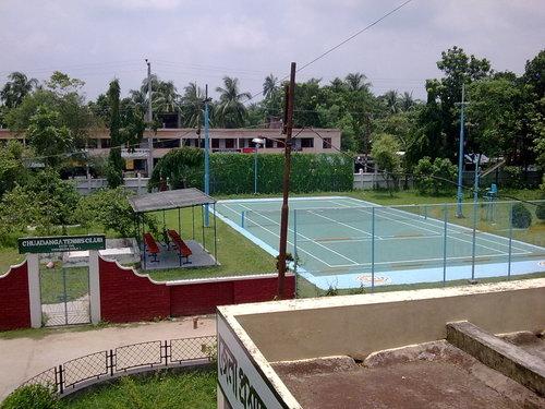
Cultural organisations: Club 81, press club 2, public library 4, cinema hall 15, theatre group 27, theatre stage 2, women's organisation 4, literary society 1, stadium 1, auditorium 4.
Main occupations: Agriculture 40.33%, agricultural labourer 28.08%, wage labourer 2.69%, commerce 12.69%, service 6.08%, transport 1.91% and others 8.22%.
Land use: Total cultivable land 89420 hectares; fallow land 253.74 hectares; single crop 14.80%, double crop 73.35% and treble crop 11.85%; cultivable land under irrigation 57%.
Land control:Among the peasants 37% are landless, 43% small, 18% intermediate and 2% rich; cultivable land per head 0.11 hectare.
Main crops Paddy, jute, wheat, potato, sugarcane, brinjal, onion, garlic, pulses, betel leaf and pumpkin.
Main fruits Mango, jackfruit, litchi, papaya, guava, betel nut, coconut and banana.
Fisheries, dairies, poultries Poultry 85, fishery 18, dairy 18 and hatchery 2.
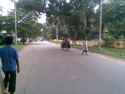
Communication facilities: Roads: pucca 203 km, semi pucca 211 km and mud road 1322 km; railways 51.42 km; railway station 3.
Manufactories: Cotton mills, sugar mill, bread and biscuit factory, spinning mills, textile mills, aluminium factory, pharmaceuticals, rice mill, chira mill, oil mill, flour mill, ice factory, saw mill and welding.
Cottage industries: Weaving, bamboo work, goldsmith, blacksmith, potteries, wood work, tailoring.
Hats, bazars and fairs Total number of hats and bazars are 80, most noted of which are Chuadanga, Alamdanga, Munshiganj, Gokulkhali, Dugdugi, Jibannagar, Shialmari, Damurhuda, Bhalaipur and Bara Bazar; fair 5, Dingedaha Merete Mela, Baruni and Gangapuja Melas are notable.
Main exports: Paddy, jute, biscuit, sugar, tobacco, sugarcane, date molasses, betel nut, betel leaf, mango, jackfruit and banana.
NGO activities: Operationally important NGOs are brac, CARE, asa, caritas, grameen bank, Janakalayan, Palli Unnayan Sangstha, Pratyasha, Srijani, Jagarani Chakra, WAVE, Usha.
Health centres: Zila sadar hospital 1, upazila health complex 4, family planning centre 29, satellite clinic 3, TB hospital 1, diabetic hospital 1, eye hospital 1, maternity and child care centre 1, infectious diseases hospital 1.
Chuadanga (Town) stands on the bank of the river Mathabhanga. It consists of 9 wards and 41 mahallas. It is a municipal town, though established in 1960, it started functioning in 1965. The town has an area of 36.12 sq km. It has a population of 72081; male 50.13%, female 49.87%. Literacy rate among the town people is 48%.
Administration: Chuadanga sub-division was within Nadia district before the Partition. In 1947, excepting Krishnagar thana, the whole territory of Chuadanga sub-division was included in Kushtia district. It was turned into a district in 1984. The district consists of 4 municipalities, 36 wards, 93 mahallas, 4 upazilas, 31 union parishads, 421 mouzas and 514 villages. The upazilas are chuadanga sadar, alamdanga, damurhuda, jibannagar. Municipalities are Chuadanga Sadar, Alamdanga, Damurhuda and Jibannagar
Archaeological heritage and relics: Three domed Chuadanga Bara Mosque, Gholdari Mosque (1006 AD), Thakurpur Mosque, Shibnagar Mosque, Jamjami Mosque, Hazar Duari School (Damurhuda), Karpasdanga Neelkuthi, Gholdari Neelkuthi.
Historical events: It is supposed from the records of the Greek historians and geographical formations that this region was a part of the kingdom of Gangaridhi and there was a city called Gangey here. From the beginning of the British rule the people of Chuadanga participated in many uprisings and democratic movements. Their contributions to uprisings and movements including the wahabi movement (1831), faraizi movement (1838-47), sepoy revolt (1857), Indigo Rebellion (1859-60), khilafat movement (1920), swadeshi movement (1906), Non cooperation, Violation of Law and Satyagraha Movements (1920-40), Quit India Movement or August Revolt (1942) and Freedom Movement are notable.
Population 987382; male 50.82%, female 49.18%; Muslim 96.73%, Hindu 2.96%, Christian 0.02% and others 0.29%.
Religious institutions: Mosque 448, temple 18, church 4, tomb 18.
Literacy and educational institutions: Average literacy 25.2%; male 30.5% and female 19.6%. Educational institutions: college 12, high school 48, junior high school 7, government primary school 257, non-government primary school 120, primary training institute 1, vocational training institute 1, nursing institute 1, madrasa 63, kindergarten school 3. Noted old educational institutions: Victoria Jubilee Government High School (1880), Alamdanga High School (1914), Natudaha High School (1906), Jibannagar Pilot High School (1957), Hazar Duari School.
Cultural organisations: Club 81, press club 2, public library 4, cinema hall 15, theatre group 27, theatre stage 2, women's organisation 4, literary society 1, stadium 1, auditorium 4.
Main occupations: Agriculture 40.33%, agricultural labourer 28.08%, wage labourer 2.69%, commerce 12.69%, service 6.08%, transport 1.91% and others 8.22%.
Land use: Total cultivable land 89420 hectares; fallow land 253.74 hectares; single crop 14.80%, double crop 73.35% and treble crop 11.85%; cultivable land under irrigation 57%.
Land control:Among the peasants 37% are landless, 43% small, 18% intermediate and 2% rich; cultivable land per head 0.11 hectare.
Main crops Paddy, jute, wheat, potato, sugarcane, brinjal, onion, garlic, pulses, betel leaf and pumpkin.
Main fruits Mango, jackfruit, litchi, papaya, guava, betel nut, coconut and banana.
Fisheries, dairies, poultries Poultry 85, fishery 18, dairy 18 and hatchery 2.
Communication facilities: Roads: pucca 203 km, semi pucca 211 km and mud road 1322 km; railways 51.42 km; railway station 3.
Manufactories: Cotton mills, sugar mill, bread and biscuit factory, spinning mills, textile mills, aluminium factory, pharmaceuticals, rice mill, chira mill, oil mill, flour mill, ice factory, saw mill and welding.
Cottage industries: Weaving, bamboo work, goldsmith, blacksmith, potteries, wood work, tailoring.
Hats, bazars and fairs Total number of hats and bazars are 80, most noted of which are Chuadanga, Alamdanga, Munshiganj, Gokulkhali, Dugdugi, Jibannagar, Shialmari, Damurhuda, Bhalaipur and Bara Bazar; fair 5, Dingedaha Merete Mela, Baruni and Gangapuja Melas are notable.
Main exports: Paddy, jute, biscuit, sugar, tobacco, sugarcane, date molasses, betel nut, betel leaf, mango, jackfruit and banana.
NGO activities: Operationally important NGOs are brac, CARE, asa, caritas, grameen bank, Janakalayan, Palli Unnayan Sangstha, Pratyasha, Srijani, Jagarani Chakra, WAVE, Usha.
Health centres: Zila sadar hospital 1, upazila health complex 4, family planning centre 29, satellite clinic 3, TB hospital 1, diabetic hospital 1, eye hospital 1, maternity and child care centre 1, infectious diseases hospital 1.
Nearby cities:
Coordinates: 23°39'7"N 88°51'8"E
- Khulna 102 km
- Kolkata 130 km
- Durgapur 167 km
- Kharagpur 220 km
- Dhanbad 253 km
- Bokaro Steel City 291 km
- Jamshedpur 300 km
- Siliguri 354 km
- Ranchi 370 km
- Patna 449 km
- Chuadanga District 8.2 km
- Damurhuda Upazila HQ 10 km
- Alamdanga Upazila HQ 15 km
- Baradi BADC Farm 15 km
- Raisha Beel 16 km
- Meherpur District 20 km
- Gangni Upazila HQ 21 km
- Mujibnagar Upazila 25 km
- Meherpur Sadar Upazila HQ District Town 26 km
- Khulna Division 97 km
Comments