Meherpur District
Bangladesh /
Meherpur /
World
/ Bangladesh
/ Meherpur
/ Meherpur
district (administrative division), draw only border, third-level administrative division
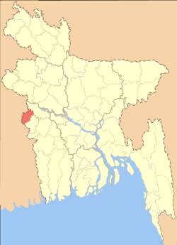
Meherpur District has an area of 716.08 sqkm and its one of the smaller district in Bangladesh just after Narayanganj (683 sqkm) and Jhalokati. It is bounded by Kushtia District and West Bengal of India on the north, Chuadanga District and West Bengal on the south, Chuadanga and Kushtia districts on the east, and West Bengal on the west. Meherpur is a historical district of Bangladesh for the fact that the Proclamation of Independence was solemnly made at the village Baidyanathtola (now Mujibnagar), on 17 April 1971 of this district. The entire Proclamation ceremony was organized by local leaders under the supervision of Momeen Chowdhury and MM Rustom Ali. [2] The first provisional government of Bangladesh was formed here under the leadership of Tajuddin Ahmed & Syed Nazrul Islam. After that day on 18 April 1971, the Pak army killed 8 persons at village Amjhupi. Meherpur was a Sub-Division in Kushtia District and in the year 1983 (1984) it was declared as a District by Ershad Government. The Meherpur Municipality is one of the oldest Municipality in Bangladesh which was established on 1859 when Meherpur was a part of District Nadia. Meherpur district is divided into three upazilas, Gangni Upazila, Meherpur Sadar Upazila and Mujibnagar Upazila.
Wikipedia article: http://en.wikipedia.org/wiki/Meherpur_District
Nearby cities:
Coordinates: 23°47'17"N 88°43'12"E
- Chuadanga District 10 km
- Patran Tehsil 1449 km
- Bicholim Taluka 1794 km
- Pedne Taluka 1806 km
- Bardez Taluka 1809 km
- Tiswadi 1812 km
- Tehsil Kallar Syedan 1856 km
- Garadagh district 4112 km
- Tegh Region 4341 km
- Meghri Municipality 4346 km
- Gangni Upazila HQ 4.6 km
- Baradi BADC Farm 6.9 km
- Nuton Durbes pur 10 km
- Mujibnagar Upazila 17 km
- Damurhuda Upazila HQ 22 km
- Alamdanga Upazila HQ 23 km
- Karpasdanga 23 km
- Kutubpur 24 km
- Raisha Beel 26 km
- Khulna Division 117 km