Wadi Bakht
Libya /
al-Kufrah /
World
/ Libya
/ al-Kufrah
/ al-Kufrah
, 349 km from center (الكفرة)
World / Egypt
archeological site, neolithic age
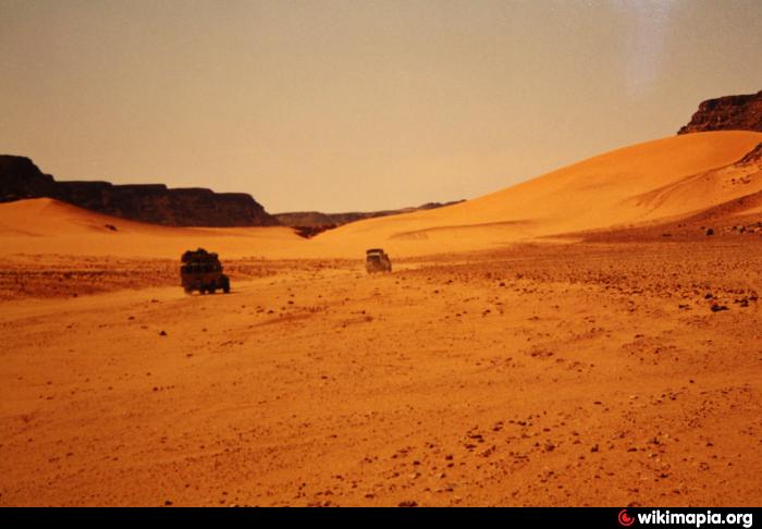
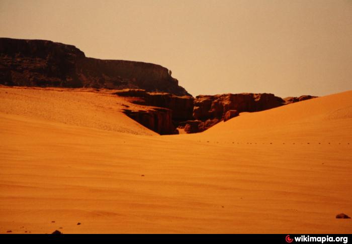
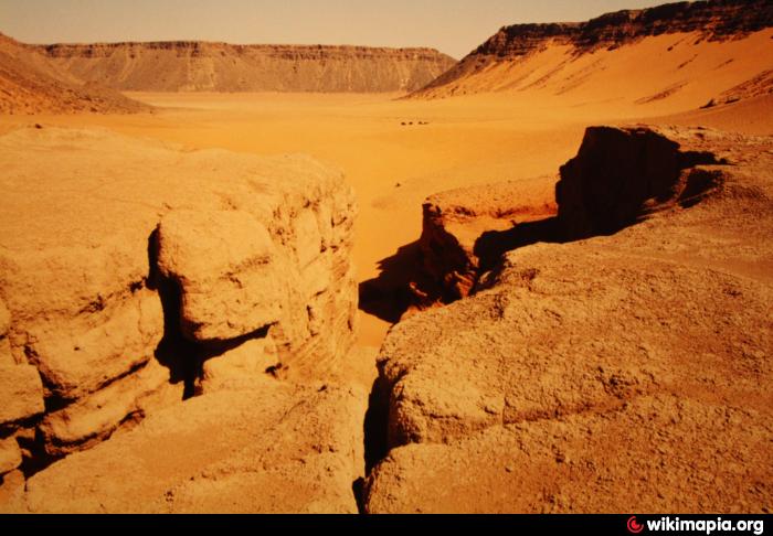
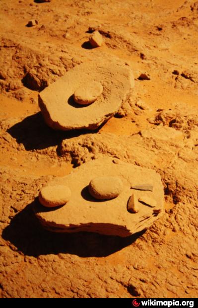
in stone age times, the valley was blocked by a natural dam of sand, which still is to be seen today. The dam created a lake and stone age people settled at the shores. When the dam broke, the stone age settlers obviously had to leave the valley. The site was explored by the German Heinrich Barth Institute Cologne. Be careful when entering the site west of the dam and do not take anything away!!
Nearby cities:
Coordinates: 23°12'9"N 26°18'24"E
- Maghara al Qantara 41 km
- Petroglyphs 106 km
- stone-age petroglyphs 117 km
- Wadi Sura 119 km
- Wadi Abdel Malik, upper section 121 km
- Wadi Hamra 127 km
- Yardang Field / Mudpans 168 km
- Petroglyph Site 180 km
- Karkur Talh 180 km
- Abu Ballas 194 km
- Wadi Wass'a 27 km
- Kamal-al-Din-Plateau 32 km
- Gilf Kebir Crater Field 93 km
- Gilf al Kebir 96 km
- Arkenu Dune, northern section 99 km
- Abu Ras Plateau 120 km
- Gilf-Saghir 120 km
- Arkenu Dune, cental section 146 km
- Abu Saad Plateau 151 km
- East Owaynat 229 km