Devils Playground
USA /
California /
Twentynine Palms Base /
World
/ USA
/ California
/ Twentynine Palms Base
World / United States / California
region, interesting place
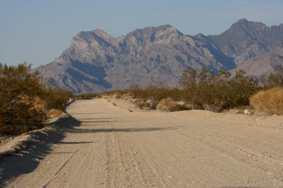
The Devils Playground is a large sandy region in the Mojave Desert in the state of California in the United States. Dunes and salt flats stretch for approximately 40 miles in a generally northwest-southeasterly direction in the Mojave National Preserve. The "playground" lies between the town of Baker and the Providence Mountains.
The Devils Playground has been declared a Wilderness – vehicular travel on the many existing roads in the area is now prohibited.
The Devils Playground has been declared a Wilderness – vehicular travel on the many existing roads in the area is now prohibited.
Wikipedia article: http://en.wikipedia.org/wiki/Devils_Playground
Nearby cities:
Coordinates: 35°1'22"N 115°52'12"W
- Val Jean Dunes 77 km
- Little Dumont Dunes 82 km
- Means Dry Lake 90 km
- Goodsprings, Nevada 99 km
- Deb Analog 149 km
- Six Spring Canyon 156 km
- Ground Marking : Compass Rose (Aerial Aid-to-Navigation) 183 km
- Supersonic Low Level test area 186 km
- Rainbow Canyon / The Jedi Transition 215 km
- Olancha Dunes 239 km
- Old Dad Mountains 12 km
- Kelso Mountains 13 km
- Kelso Sand Dunes 15 km
- Marl Mountains 23 km
- Cornfield Canyon 30 km
- Mojave National Preserve 30 km
- Providence Mountains State Recreation Area 34 km
- Baker Grade 35 km
- Yucca Hills 44 km
- Ivanpah Lake 71 km
Comments