Seonginbong
| peak
Korea (South) /
Kangwon /
Samchok /
Dodong-ri, San39
World
/ Korea (South)
/ Kangwon
/ Samchok
World / South Korea / Gyeongsangbuk-do
peak
Add category
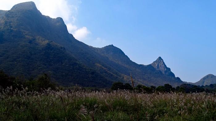
Seonginbong is the highest mountain peak on the island and has an elevation of 984m/3,228ft.
The foot of Seonginbong Peak is covered with a thick primeval forests designated as Natural Monument #189, and the rare plants found only in Ulleungdo Island make this place of unique scenic beauty. The Nari Basin, the north of the mountain, is a caldera formed by volcanic activities and the only flat ground on Ulleungdo.
The foot of Seonginbong Peak is covered with a thick primeval forests designated as Natural Monument #189, and the rare plants found only in Ulleungdo Island make this place of unique scenic beauty. The Nari Basin, the north of the mountain, is a caldera formed by volcanic activities and the only flat ground on Ulleungdo.
Wikipedia article: http://en.wikipedia.org/wiki/Seonginbong
Nearby cities:
Coordinates: 37°29'39"N 130°52'18"E
- Tugubong 4.2 km
- Ulleungdo (Ulleung Island) 1.6 km
- The Pristine Forest at Seongin Peak 1.7 km
- Location of the loss of the cruiser "Svetlana" 107 km
- Jukbyeon-myeon 137 km
- KHNP, Hanul Nuclear Power Plant 139 km
- Hupo-myeon 155 km
- Tonghae Satellite Launching Station 388 km
- Hwadae-gun (Hwadae County) 389 km
- Myŏngch'ŏn-gun (Myonchon County) 413 km
- Kilju-gun (Kilju County) 421 km