Tonghae Satellite Launching Station
| military, spaceport
Korea (North) /
Hamgyongbukto /
Myongchon /
World
/ Korea (North)
/ Hamgyongbukto
/ Myongchon
World / North Korea / Hamgyŏng-bukto
military, spaceport
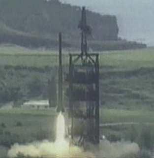
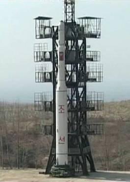
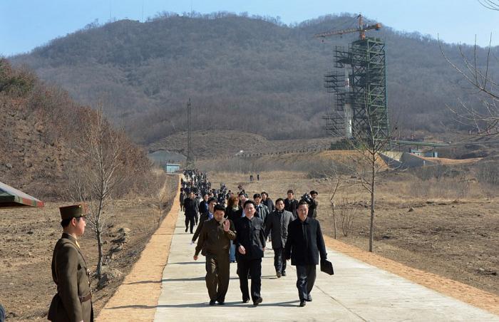
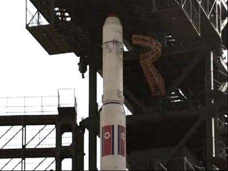
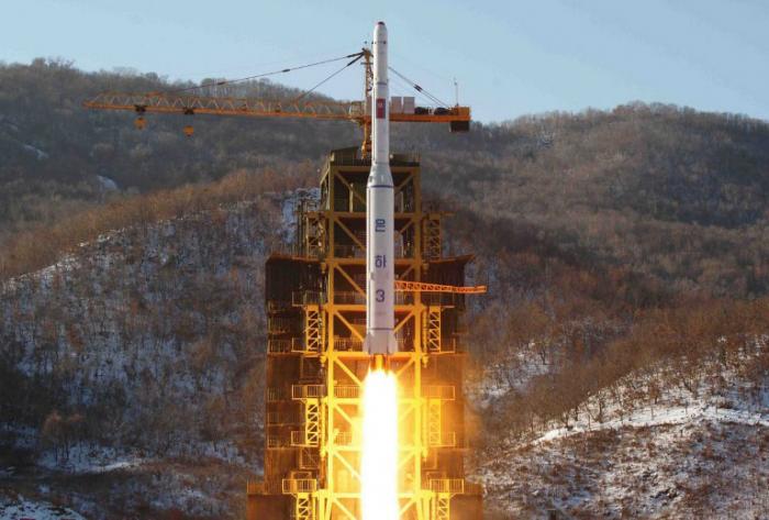
This facility began life as a missile testing ground. In February 2009, the DPRK announced this would be the site for launching its experimental Kwangmyongsong-2 satellite into space using one of its Unha-2 delivery rockets. While officially under the auspices of the Korean Committee for Space Technology, this facility is under the jurisdiction of the National Defense Commission (NDC) by way of the Second National Academy of Sciences.
www.globalsecurity.org/wmd/world/dprk/nodong.htm
www.globalsecurity.org/wmd/world/dprk/nodong.htm
Wikipedia article: http://en.wikipedia.org/wiki/Musudan-ri
Nearby cities:
Coordinates: 40°51'27"N 129°40'14"E
- Engine test stand 0.8 km
- No-dong Range Control Facility 1.1 km
- Missile test facility and checkout building 1.1 km
- Missile control building 1.2 km
- Tracking and Communication / Observation post 1.3 km
- Underground HQ and depots 8.7 km
- Abandoned airstrip 26 km
- ROK Air Force 8355th Group 386 km
- Approximate location of the loss of the cruiser "Dmitry Donskoy" 389 km
- Jukbyeon Emergency Airstrip/Uljin Emergency Runway 422 km
- Hwadae-gun (Hwadae County) 7 km
- Myŏngch'ŏn-gun (Myonchon County) 24 km
- Kilju-gun (Kilju County) 45 km
- The Pristine Forest at Seongin Peak 387 km
- Ulleungdo (Ulleung Island) 387 km
- Seonginbong 388 km
- KHNP, Hanul Nuclear Power Plant 420 km
- Jukbyeon-myeon 423 km
- Location of the loss of the cruiser "Svetlana" 429 km
- Hupo-myeon 465 km
Comments