Cardigan
United Kingdom /
Wales /
Aberporth /
World
/ United Kingdom
/ Wales
/ Aberporth
World / United Kingdom / Wales
town, county town - UK/Ireland
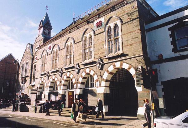


Cardigan (Welsh: Aberteifi) is the county town of Cardiganshire in Mid Wales. It lies on the tidal estuary of the River Teifi at the point where Cardiganshire meets Pembrokeshire to the south. It is the second largest town in Cardiganshire whose administrative centre is now Aberaeron instead. The town's population was 4,203 inhabitants in 2001. It is a significant regional administrative centre for West Wales, harbouring a hospital, college, a modern arts centre (with two-screen cinema) and a currently under-used nineteenth century guildhall together with a theatre and good shopping facilities. Cardigan is twinned with Brioude, France.
In 2006 and 2008 the town undertook a co-ordinated programme of building works restoring many of the facades of the town centre shops in a sympathetic style. The quayside has been rebuilt with a new civic area and landing stage. The attached polygon represents the established settlement boundary for town planning purposes rather than a political/electoral ward boundary, as the town is currently divided amongst three Ceredigion electoral wards each of which has significant rural part as well.
for more on the history of Cardigan/Aberteifi see @:
www.visitcardigan.com/history-of-cardigan-west-wales.ph...
for detailed on-line large-scale map from Ceredigion C.C. website showing electoral wards see @:map.ceredigion.gov.uk/connect/?mapcfg=COUNCIL_AND_DEMOC...
Wikipedia article: http://en.wikipedia.org/wiki/Cardigan,_Ceredigion
Nearby cities:
Coordinates: 52°5'16"N 4°39'28"W
- Carmarthen 32 km
- Llanelli 53 km
- Port Talbot 77 km
- Bridgend 95 km
- Pontypridd 102 km
- Cardiff 112 km
- Barry 119 km
- Weston-super-Mare 140 km
- Bridgwater 153 km
- Taunton 156 km
- Crug Mawr Solar Field 2.6 km
- Poppit Sands 3.3 km
- Cardigan Island 5.4 km
- Cemaes Head 5.6 km
- West Wales Airport (ICAO: EGFA) 7.4 km
- MOD Aberporth 8.5 km
- Llwyn Ddu Solar Field 9 km
- Caerwedros 22 km
- Llanerchaeron Park and Gardens 33 km
- Cardigan Bay 39 km