Royal Arsenal (London)
United Kingdom /
England /
Westham /
London
World
/ United Kingdom
/ England
/ Westham
World / United Kingdom / England
residential neighbourhood
Add category

Originally known as the Woolwich Warren, The Arsenal, Dockyard and Ropeyard at Woolwich formed, in their time, the largest military-industrial complex in Europe. At its peak, during World War I, the Royal Arsenal extended over some 1300 acres (5.3 km²) and employed around 80,000 people.
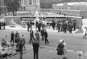
This area is now home to the Greenwich heritage museum and Firepower- the museum of the Royal Artillery. Also a development of luxury flats with the Royal Artillery Quays (top right) on the former gunnery fields.
www.royal-arsenal.com/exhibition.html
This area is now home to the Greenwich heritage museum and Firepower- the museum of the Royal Artillery. Also a development of luxury flats with the Royal Artillery Quays (top right) on the former gunnery fields.
www.royal-arsenal.com/exhibition.html
Wikipedia article: http://en.wikipedia.org/wiki/Royal_Arsenal
Nearby cities:
Coordinates: 51°29'36"N 0°4'16"E
- Camden Park Estate 8.9 km
- River View Park 23 km
- Hutton Mount Private Estate 23 km
- King Edward Road Estate 26 km
- Marden Ash 26 km
- Walderslade 34 km
- Upper Deal 95 km
- Ravenswood 98 km
- Sint André Area 184 km
- Sun Parks Oostduinkerke 188 km
- Woolwich 1.5 km
- Plumstead 2.1 km
- The Royal Docks 2.2 km
- Charlton 2.7 km
- Beckton 2.7 km
- Thamesmead 3.2 km
- Royal Borough of Greenwich 3.3 km
- Canning Town 4 km
- London Borough of Newham 4.9 km
- London Borough of Bexley 6.3 km