STOL 101
USA /
California /
Camp Pendleton South /
World
/ USA
/ California
/ Camp Pendleton South
World / United States / California
aircraft, training center

Designed to support vertical takeoff fixed wing aircraft operations.
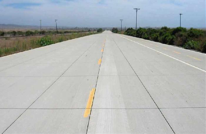
The STOL 101 is an actual strip of roadway.
These facilities are open to rotary wing operations as well.
The STOL 101 is an actual strip of roadway.
These facilities are open to rotary wing operations as well.
Nearby cities:
Coordinates: 33°18'26"N 117°28'17"W
- March Field Air Museum 67 km
- West Mission Boulevard, 1601 88 km
- Brackett Airport [POC/KPOC] 93 km
- Vought Aircraft Company 106 km
- Hercules Campus at Playa Vista 115 km
- Southern California Logistics Airport Boneyard 146 km
- Weapons Survivability Lab. aircraft compound. 270 km
- Arnold Meadow Airstrip 489 km
- Steve Fossett's crash area 508 km
- BCPA Flight 304 Crash Site 634 km
- Horno Canyon 5 km
- Edson Range 6.6 km
- Marine Corps Base Camp Pendleton 7 km
- Camp Horno 53 Area 8.3 km
- 52 Area (School of Infantry West) 11 km
- Camp San Mateo (62 Area) 15 km
- San Onofre State Beach 16 km
- Southwest San Clemente 18 km
- Kelp Reef Project 18 km
- Orange County, California 48 km
Comments