TVA Watts Bar Dam
USA /
Tennessee /
Spring City /
World
/ USA
/ Tennessee
/ Spring City
World / United States / Tennessee
dam, hydroelectric power station/plant
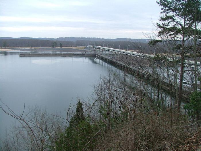
Watts Bar Dam, on the Tennessee River in Tennessee about halfway between Knoxville and Chattanooga, provides flood control as well as hydroelectric power. Spanning the river between Meigs County and Rhea County, it is one of nine Tennessee Valley Authority (TVA) dams on the Tennessee River. The dam impounds Watts Bar Lake and feeds into Chickamauga Lake. State Route 68 crosses the dam.
Construction of Watts Bar Dam began in 1939 and was completed in 1942.
Construction of Watts Bar Dam began in 1939 and was completed in 1942.
Wikipedia article: http://en.wikipedia.org/wiki/Watts_Bar_Dam
Nearby cities:
Coordinates: 35°37'9"N 84°46'50"W
- Dam Number 10 216 km
- McAlpine Dam 310 km
- TVA Pickwick Landing Dam 321 km
- Barkley Dam 346 km
- Kentucky Dam 351 km
- Dreher Shoals Dam 368 km
- Sardis Dam 478 km
- Sutton Dam and reservoir 496 km
- Grenada Lake Dam 498 km
- J.E. Roush Fish and Wildlife Area 586 km
- TVA Watts Bar Nuclear Plant 2.3 km
- Ten Mile, Tennessee 5.9 km
- Spring City, Tennessee 11 km
- Quarry 14 km
- Piney Falls State Natural Area 14 km
- Rhea County High School 15 km
- Bonham, Tennessee 15 km
- Quarry 17 km
- Dayton Golf & Country Club 19 km
- Mark Anton Airport 20 km