Wolverhampton
United Kingdom /
England /
Wolverhampton /
World
/ United Kingdom
/ England
/ Wolverhampton
World / United Kingdom / England
city, borough, draw only border


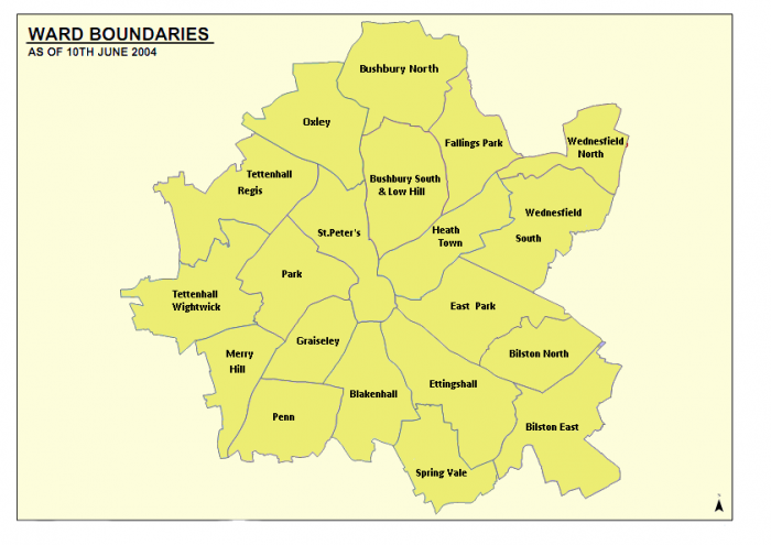
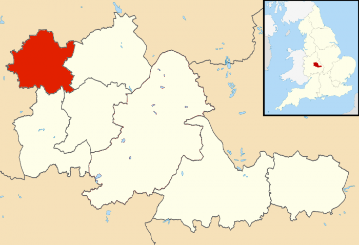
Wolverhampton is a city and metropolitan borough in the West Midlands, England, one of seven such in the metropolitan county. In 2004, the local government district had an estimated population of 239,100; the wider Urban Area had a population of 251,462, which makes it the 13th most populous city in England.
Historically a part of Staffordshire, and forming part of the metropolitan county of the West Midlands from 1974, the city is commonly recognised as being named after Lady Wulfrun, who founded the town in 985: its name coming from Anglo-Saxon Wulfrūnehēantūn = "Wulfrūn's high or principal enclosure or farm" or the first part may have been named after related Wulfhere, a Mercian King. Regardless Wulfrun is commonplace shorthand– for example, the Wulfrun Centre and Wulfrun Hall.
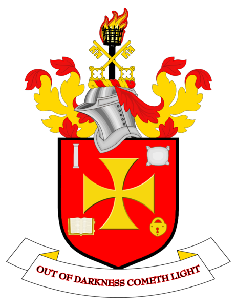
The city's name is often abbreviated to Wolvo or "Wolves" as in the nickname for the City's well known association football team "Wolverhampton Wanderers". The city council's motto is "Out of darkness, cometh light". People from Wolverhampton are known as Wulfrunians, or, sometimes colloquially, "Yam Yams" due to regional phraseology in the most concentrated forms of its own dialects.
The city grew initially as a market town with specialism within the woollen trade. During and after the Industrial Revolution, the city became a major industrial centre, with mining (mostly coal, limestone and iron ore) as well as production of steel, japanning, locks, motorcycles and cars – including the first vehicle to hold the Land speed record at over 200 mph. Today, the major industries within the city are both engineering based (including a large aerospace industry) and within the service sector.
www.wolverhampton.gov.uk/
www.cityofwolverhampton.com/
For official WCC detailed on-line digital map of City limits used in drawing attached polygon see :
www.cartoplus.co.uk/wolverhampton_2/wlvhmptn.htm#
Historically a part of Staffordshire, and forming part of the metropolitan county of the West Midlands from 1974, the city is commonly recognised as being named after Lady Wulfrun, who founded the town in 985: its name coming from Anglo-Saxon Wulfrūnehēantūn = "Wulfrūn's high or principal enclosure or farm" or the first part may have been named after related Wulfhere, a Mercian King. Regardless Wulfrun is commonplace shorthand– for example, the Wulfrun Centre and Wulfrun Hall.
The city's name is often abbreviated to Wolvo or "Wolves" as in the nickname for the City's well known association football team "Wolverhampton Wanderers". The city council's motto is "Out of darkness, cometh light". People from Wolverhampton are known as Wulfrunians, or, sometimes colloquially, "Yam Yams" due to regional phraseology in the most concentrated forms of its own dialects.
The city grew initially as a market town with specialism within the woollen trade. During and after the Industrial Revolution, the city became a major industrial centre, with mining (mostly coal, limestone and iron ore) as well as production of steel, japanning, locks, motorcycles and cars – including the first vehicle to hold the Land speed record at over 200 mph. Today, the major industries within the city are both engineering based (including a large aerospace industry) and within the service sector.
www.wolverhampton.gov.uk/
www.cityofwolverhampton.com/
For official WCC detailed on-line digital map of City limits used in drawing attached polygon see :
www.cartoplus.co.uk/wolverhampton_2/wlvhmptn.htm#
Wikipedia article: http://en.wikipedia.org/wiki/Wolverhampton
Nearby cities:
Coordinates: 52°35'27"N 2°7'39"W
- Sandwell 3.2 km
- Dudley (Metropolitan Borough of) 5.7 km
- Walsall (Metropolitan Borough of) 8.7 km
- Solihull (Metropolitan Borough) 19 km
- Stafford 48 km
- Newcastle-under-Lyme Borough 63 km
- Metropolitan Borough of Rotherham 111 km
- Borough of Basingstoke and Deane 142 km
- London Borough of Hillingdon 154 km
- London Borough of Croydon 187 km
- Dunstall Park 1.8 km
- South Staffordshire 2.4 km
- Smestow Valley Local Nature Reserve 2.9 km
- Jaguar Engine Plant 4.9 km
- Bilbrook CP 5.1 km
- Featherstone CP 6.3 km
- Perton CP 6.5 km
- Codsall CP 6.7 km
- Saredon CP 8.6 km
- Brewood and Coven CP 8.6 km
Comments