Sandwell (West Bromwich)
United Kingdom /
England /
Oldbury-Smethwick /
West Bromwich
World
/ United Kingdom
/ England
/ Oldbury-Smethwick
World / United Kingdom / England
borough, draw only border
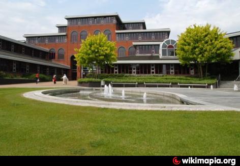
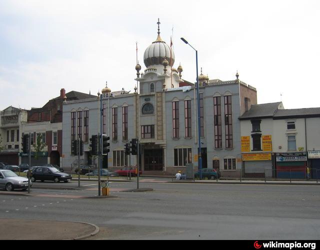
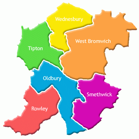
Sandwell is a metropolitan borough in and a part of the metropolitan County of the West Midlands with a population of around 289,100, and an area of 33 square miles (85 km2). The borough is named after Sandwell Priory, and spans a densely populated part of both the Black Country, and the West Midlands conurbation, encompassing the urban towns of Blackheath, Cradley Heath, Oldbury, Rowley Regis, Smethwick, Tipton, Tividale, Wednesbury, and West Bromwich. West Bromwich is the most populous town in Sandwell, but Sandwell Council House (the headquarters of Sandwell's local government) is located in Oldbury.
The Metropolitan Borough of Sandwell was formed in 1974 as part of the provisions of the Local Government Act 1972 and is an amalgamation of the former County Borough of Warley and County Borough of West Bromwich. For its first 12 years Sandwell had a two-tier system of local government; Sandwell Council shared power with the West Midlands County Council. Since the Local Government Act 1985 Sandwell Council has effectively been a unitary authority, serving as the sole executive, deliberative and legislative body responsible for local policy, setting council tax, and allocating budget in the district.Policing, fire services and some other protection and environmental services continue to be administered on a West Midlands County-wide basis.
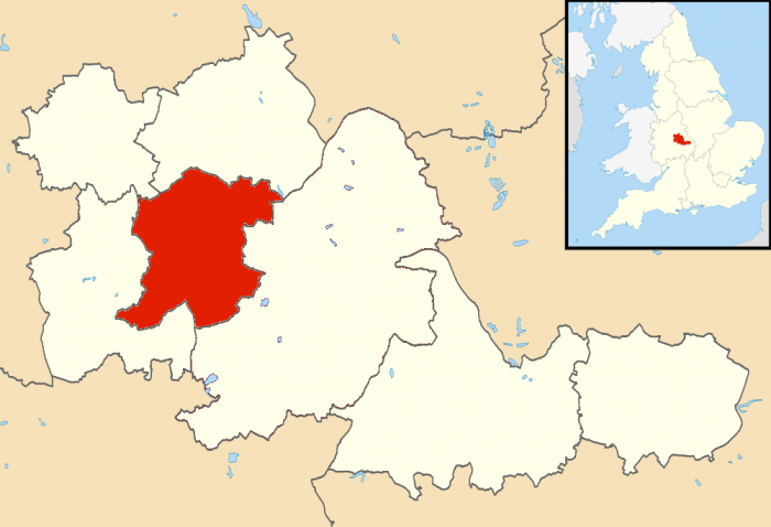
Bordering Sandwell is the City of Birmingham to the east, the Metropolitan Borough of Dudley to the south and west, the Metropolitan Borough of Walsall to the north, and the City of Wolverhampton to the north-west. Spanning the Metropolitan Borough of Sandwell are the parliamentary constituencies of West Bromwich West, West Bromwich East and Warley, and part of Halesowen and Rowley Regis, which crosses into the Metropolitan Borough of Dudley.
Since 2009, there has been a petition to merge Sandwell with Birmingham. If successful, Birmingham would substantially increase in size with a combined population of over 1,300,000
www.sandwell.gov.uk/
Official Sandwell M.B.C. large-scale downloadable (pdf format)map for the Sanwell UDP Proposals procedure and as used to draw attached polygon can be found @ :
www.sandwell.gov.uk/downloads/file/2113/proposals_map
The Metropolitan Borough of Sandwell was formed in 1974 as part of the provisions of the Local Government Act 1972 and is an amalgamation of the former County Borough of Warley and County Borough of West Bromwich. For its first 12 years Sandwell had a two-tier system of local government; Sandwell Council shared power with the West Midlands County Council. Since the Local Government Act 1985 Sandwell Council has effectively been a unitary authority, serving as the sole executive, deliberative and legislative body responsible for local policy, setting council tax, and allocating budget in the district.Policing, fire services and some other protection and environmental services continue to be administered on a West Midlands County-wide basis.
Bordering Sandwell is the City of Birmingham to the east, the Metropolitan Borough of Dudley to the south and west, the Metropolitan Borough of Walsall to the north, and the City of Wolverhampton to the north-west. Spanning the Metropolitan Borough of Sandwell are the parliamentary constituencies of West Bromwich West, West Bromwich East and Warley, and part of Halesowen and Rowley Regis, which crosses into the Metropolitan Borough of Dudley.
Since 2009, there has been a petition to merge Sandwell with Birmingham. If successful, Birmingham would substantially increase in size with a combined population of over 1,300,000
www.sandwell.gov.uk/
Official Sandwell M.B.C. large-scale downloadable (pdf format)map for the Sanwell UDP Proposals procedure and as used to draw attached polygon can be found @ :
www.sandwell.gov.uk/downloads/file/2113/proposals_map
Wikipedia article: http://en.wikipedia.org/wiki/Sandwell
Nearby cities:
Coordinates: 52°30'53"N 2°0'26"W
- Solihull (Metropolitan Borough) 9 km
- Dudley (Metropolitan Borough of) 13 km
- Walsall (Metropolitan Borough of) 17 km
- Stafford 59 km
- Newcastle-under-Lyme Borough 74 km
- Metropolitan Borough of Rotherham 116 km
- Borough of Basingstoke and Deane 131 km
- London Borough of Hillingdon 142 km
- London Borough of Barnet 150 km
- London Borough of Croydon 175 km
- Marl Hole Park 0.4 km
- Greets Green Playing Fields 1.1 km
- Jesson Playing Field 1.5 km
- Dartmouth Park 1.8 km
- Sandwell General Hospital 1.9 km
- M5 Junction 1 2.2 km
- Sot's Hole Nature Reserve 2.4 km
- Dartmouth Golf Club 2.9 km
- West Bromwich Cemetery 2.9 km
- Sandwell Valley Country Park 3.1 km