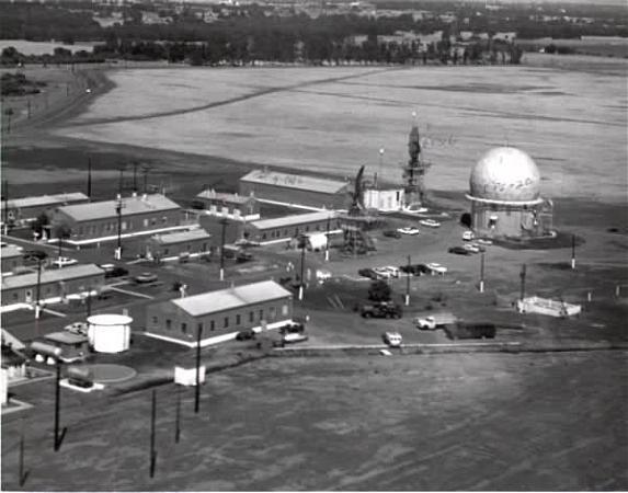
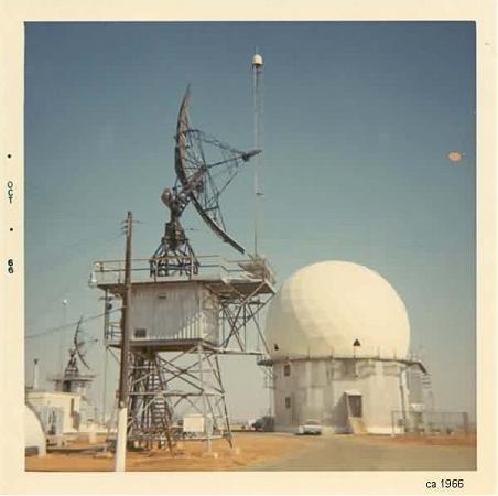
Ridgeway Park/Red Bluff Air Force Station (site)
USA /
California /
Red Bluff /
Ridge Road
World
/ USA
/ California
/ Red Bluff
World / United States / California
military, radar station, United States Air Force


Callsign: Antidote
This site became operational in 1956 under the jurisdiction of the 859th AC&W Squadron. The site used AN/MPS-8 and AN/MPS-11 radars. The AN/MPS-11 remained until 1963. In 1959 the Air Force placed AN/FPS-6 and -6A height-finder radars and removed the AN/MPS-8 from Red Bluff. SAGE operations began in 1960. In 1964 Red Bluff became an FAA/ADC joint-use facility, using the AN/FPS-67 search and AN/FPS-6 and AN/FPS-90 height-finder radars located on site. The 859th was deactivated 30 September 1970. The FAA continues to operate the AN/FPS-67B search radar.
www.radomes.org/museum/showsite.php?site=Red+Bluff+AFS%...
www.radomes.org/museum/documents/RedBluffAFSCAhoming.ht...
www.militarymuseum.org/RedBluffAFS.html
Wikipedia article: https://en.wikipedia.org/wiki/Red_Bluff_Air_Force_Station
Nearby cities:
Coordinates: 40°8'47"N 122°18'23"W
- Campbell Auxiliary Field 41 km
- Kirkwood Auxiliary Army Airfield 2 / Kirkwood Airport 42 km
- Oroville Auxiliary Field A-5 84 km
- Camp Beale (site) 129 km
- Beale Air Force Base (IATA: BAB – ICAO: KBAB) 130 km
- Yuba County Airport (MYV/KMYV) \ Marysville Army Airfield (site) 131 km
- Weapons Storage Area 133 km
- High Frequency Global Communications System, Lincoln Receiver Site 161 km
- Auburn Dam overlook/Camp Flint (site) 175 km
- Point Arena Air Force Station 176 km
- Red Bluff Municipal Airport 4.9 km
- Bend, California 14 km
- Gerber, California 16 km
- Los Molinos, California 22 km
- Lake, California 25 km
- Cottonwood, California 27 km
- Woodson Bridge State Recreation Area 31 km
- CA60 Deer Creek Ranch Airport 35 km
- Manton, California 49 km
- Logging clear cuts 54 km
Comments