Tower 48 (Istanbul Metropolitan Municipality)
Turkey /
Istanbul /
Istanbul Metropolitan Municipality
World
/ Turkey
/ Istanbul
/ Istanbul
tower, city wall, historic ruins
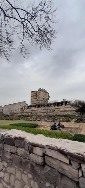
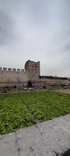
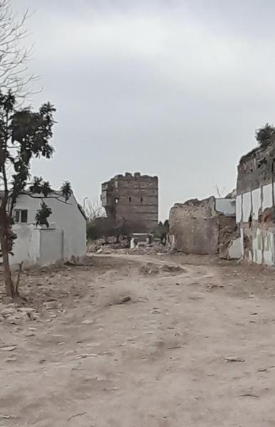
Tower 48 is a tower, city wall, historic ruins located in Istanbul Metropolitan Municipality. Tower 48 - Istanbul Metropolitan Municipality on the map.
Nearby cities:
Coordinates: 41°0'45"N 28°55'19"E
- Theodosian Walls 2.6 km
- Walls of Manuel Komnenos 3 km
- Anastasian Wall 75 km
- Kaliakra Fortress-Harbour 265 km
- Archaeological Reserve "Durankulak" 298 km
- Castrul 14 (16) / "Eski Duran Iol Tabia" 357 km
- Castrul 15 (15) 358 km
- Dacian fortress of Beidaud 415 km
- Ancient Halmyris 447 km
- Remains of ancient roads and trenching belonging to agricultural chora of Greek colony Chersonesos, IV B.C. 541 km
- Merkez Efendi 0.7 km
- İbrahim Çavuş 0.9 km
- Maltepe 1.1 km
- Zeytinburnu (District) 1.4 km
- Seyitnizam 1.4 km
- Yedikule 2.1 km
- Kazlıçeşme 2.7 km
- Fatih (District) 2.7 km
- Istanbul Province 21 km
- Sea of Marmara 62 km