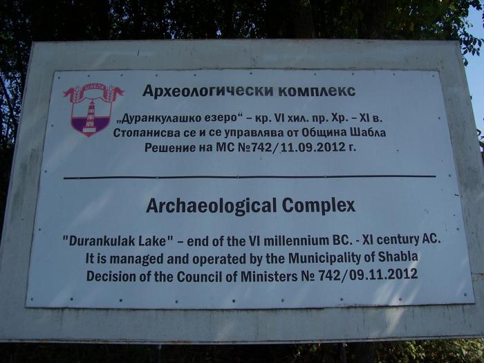
Archaeological Reserve "Durankulak"
Bulgaria /
Dobric /
Sabla /
World
/ Bulgaria
/ Dobric
/ Sabla
, 12 km from center (Шабла)
World / Bulgaria / Dobrich
archaeological site, neolithic age, cultural heritage / national heritage, interesting place, historic ruins
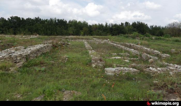

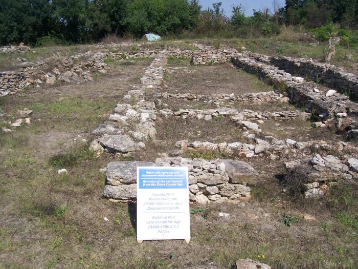


Durankulak is a prehistoric archaeological site on the Golemia ostrov (Big Island) in Durankulak lake, Bulgaria. Prehistoric settlement commenced on the small island approximately 7000 BP and lasted for thousands of years.
In this place were found:
- Finds from the Palaeolithic (over 100 centuries BC)
- The first settlements at ancient cultures sedentary, agricultural and artisanal population in Europe (54th century BC)
- First stone constructions in Europe (51 century BC)
- The oldest processed gold in the world (50th century BC)
- The first beginnings of characters in human history (50-48 century BC) harbinger of prehistoric Danubian proto-writing,
- The earliest forms of monetary exchange values (50-48 century BC)
- Here identified is the oldest phase (beginning 55-54 century BC) called Blatnitsa (in ancient name of the present village Durankulak) European Neolithic culture Hamangia.
bit.ly/3iX64Ga
bgwalk.com/en/tourist-sites/arheologicheski%20-%20kompl...
Wikipedia article: http://en.wikipedia.org/wiki/Durankulak_(archaeological_site)
Nearby cities:
Coordinates: 43°40'9"N 28°31'57"E
- Kaliakra Fortress-Harbour 34 km
- The Small Earthen Dyke 79 km
- Histria Archaeological Site 100 km
- Cemeteries Ancient pre-Christian 104 km
- Tium 369 km
- Remains of ancient roads and trenching 404 km
- Remains of ancient roads and trenching belonging to agricultural chora of Greek colony Chersonesos, IV B.C. 405 km
- State Museum-Preserve Tauric Chersonesos 409 km
- Water area of the reserve 409 km
- Necropolis of Chersonesos 410 km
- Durankulashko Ezero Protected Site 1.2 km
- Lake Durankulak 1.2 km
- Vaklinski Marsh 1.3 km
- Durankulak Lake Ramsar Site 1.5 km
- "Durankulashko Ezero" PZ Bird Directive 1.8 km
- Ezero Durankulak PZ Habitat Directive 2.4 km
- Swamp Baltata 2.7 km
- Krapets - Durankulak Beach Curve 3.1 km
- Shabla Municipality 7.7 km
- Kavarna Municipality 20 km