State Museum-Preserve Tauric Chersonesos (Sevastopol)
Ukraine /
Sevastopol /
Sevastopol /
Drevnyaya ulitsa / vulytsia Drevnia, 1
World
/ Ukraine
/ Sevastopol
/ Sevastopol
, 4 km from center (Севастополь)
World / Ukraine / Sevastopol'
place with historical importance, archaeological site, hillfort, open air museum, interesting place, invisible, UNESCO World Heritage Site, object of cultural heritage of federal importance (Russia), tourist attraction, Ancient Greece
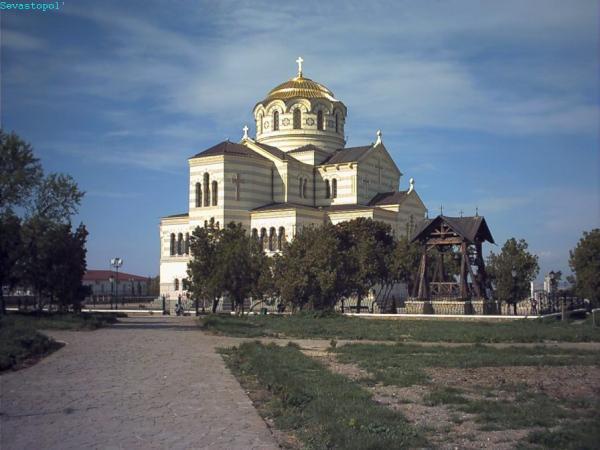

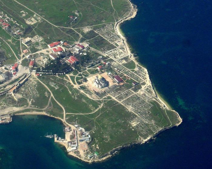
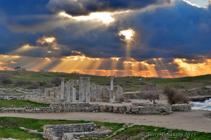
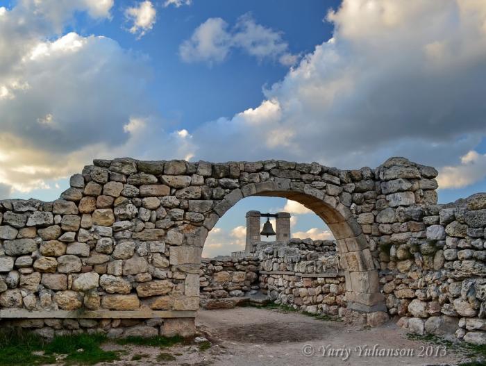

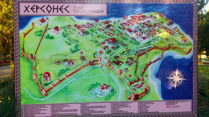
Chersonesos — ruins of ancient Greek colony 6th century B.C. — 14th A.D. Today it is the State Historical Archaeological Preserve. On the UNESCO's 100 Most Endangered World Heritage Sites list.
www.chersonesos.org
Yandex panorama: yandex.ru/maps/-/CCU5fYqqgD
www.chersonesos.org
Yandex panorama: yandex.ru/maps/-/CCU5fYqqgD
Wikipedia article: http://en.wikipedia.org/wiki/Chersonesus
Nearby cities:
Coordinates: 44°36'35"N 33°29'28"E
- Necropolis of Chersonesos 0.1 km
- Water area of the reserve 1.2 km
- Remains of ancient roads and trenching 5.2 km
- Remains of ancient roads and trenching belonging to agricultural chora of Greek colony Chersonesos, IV B.C. 5.7 km
- Tium 358 km
- Histria Archaeological Site 375 km
- Cemeteries Ancient pre-Christian 377 km
- Kaliakra Fortress-Harbour 426 km
- The Small Earthen Dyke 436 km
- Late Antiquity and Mediaeval Fortress of Dionisopol 447 km
- rangefinder 0.1 km
- Black Sea Fleet Camouflaged Command Post (Soviet Union) 0.4 km
- Rangefinder 0.4 km
- Coastal battery 12 and 13 0.4 km
- Western necropolis of Chersonesos 0.4 km
- Water area of the reserve 0.5 km
- Strelka 1.3 km
- Heracles Peninsula 6.3 km