Ocnei Street - closed segment
Romania /
Sibiu /
Ocnei Street
World
/ Romania
/ Sibiu
/ Sibiu
street, closed
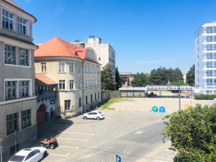
Ocnei Street segment, closed by the communist regime after 1947-48, integrated into the platform of Independenta factory (formerly Rieger), after merging various sections and workshops.
Closing this segment has created a rupture between the Historic Center and Terezian District. Sibiu City Hall plans to reopen the street, as well as reconfigure the area.
Closing this segment has created a rupture between the Historic Center and Terezian District. Sibiu City Hall plans to reopen the street, as well as reconfigure the area.
Nearby cities:
Coordinates: 45°48'10"N 24°8'59"E
- Main Alley 117 km
- Main Street 119 km
- Linia Băleanului 197 km
- Bulevardul Independentei 303 km
- Carol I Boulevard(Copou Boulevard) 303 km
- Nationala Street 321 km
- The Yellow Cobbles 352 km
- Knyaz Boris I Blvd. (continuation) 414 km
- Sloboda 467 km
- Central Loop 746 km
- Former Independenta SA (Rieger factory) 0.1 km
- Former S. Wagner factory 0.1 km
- Rieger - Independenta Halls - built 1894-96 0.1 km
- Former Libertatea S.A. Sibiu 0.3 km
- Archaeological site 0.4 km
- Lower Town 0.5 km
- Terezian 0.6 km
- Historic Center 0.7 km
- Sibiu 2.2 km
- Sibiu County 14 km