The Goose Neck
USA /
Utah /
Moab /
World
/ USA
/ Utah
/ Moab
World / United States / Utah
landmark
Add category
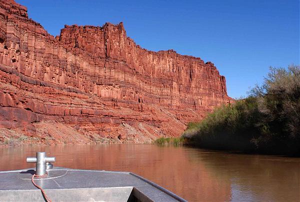


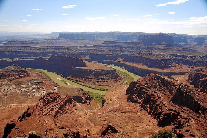
A curving neck of land consisting of a mesa and ridge inside a U-turn of the Colorado River. From Dead Horse Point State Park, the formation resembles the flight deck and superstructure of an aircraft carrier ( www.pbase.com/listorama/image/60914529 ). The only known access is by boat.
Photos documenting a trip to, and exploration of, it are here: www.pbase.com/listorama/pl_ut_moab2_goose .
Photos documenting a trip to, and exploration of, it are here: www.pbase.com/listorama/pl_ut_moab2_goose .
Nearby cities:
Coordinates: 38°26'45"N 109°45'7"W
- Pikes Peak 407 km
- Sand Creek Massacre National Historic Site 629 km
- Fort Bowie National Historic Site 700 km
- Chicken 753 km
- Fort Huachuca 754 km
- Knoche/Joint Agency Yard 1320 km
- Fort Sam Houston 1440 km
- San Jacinto Battleground State Historic Site 1658 km
- Cerro de la Silla (Saddle Hill) 1679 km
- Cahokia Mounds State Historic Site 1709 km
- Dead Horse Point State Park 6.7 km
- Long Canyon 12 km
- Upheaval Dome Impact Crater 16 km
- Monument Basin 18 km
- Canyonlands National Park 26 km
- Bowknot Bend 29 km
- Arches National Park 34 km
- Canyonlands Field (CNY/KCNY) 35 km
- Blue John Canyon 46 km
- White Wash Sand Dunes 46 km