Ellis Island
USA /
New Jersey /
Jersey City /
World
/ USA
/ New Jersey
/ Jersey City
World / United States / New Jersey
island, place with historical importance, NRHP - National Register of Historic Places


www.nps.gov/elis/
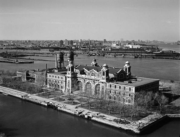
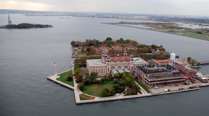
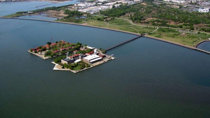
Originally much of the west shore of Upper New York Bay consisted of large tidal flats which hosted vast oyster banks, a major source of food for the Lenape population who lived in the area prior to the arrival of Dutch settlers. There were several islands which were not completely submerged at high tide. Three of them (later to be known as Liberty, Black Tom and Ellis) were given the name Oyster Islands by the settlers of New Netherland, the first European colony in the Mid-Atlantic states. The oyster beds would remain a major source of food for nearly three centuries. Landfilling to build the railyards of the Lehigh Valley Railroad and the Central Railroad of New Jersey would eventually obliterate the beds, engulf one island and bring the shoreline much closer to the others. During the Colonial period Little Oyster Island was known as Dyre's, then Bucking. In the 1760s, after some pirates were hanged from one of the island's scrubby trees, it became known as Gibbet Island. It was acquired by Samuel Ellis, a colonial New Yorker possibly from Wales, around the time of the American Revolution. Samuel Ellis advertising in Loudon's New York-Packet, January 20, 1785 New York State leased the island in 1794 and started to fortify it in 1795. Ownership was in question and legislation was passed for acquisition by condemnation in 1807 and then ceded to the United States in 1808. Shortly thereafter the War Department established a twenty-gun battery, magazine, and barracks. From 1808 until 1814 it was a federal arsenal. At the end of the War of 1812, Fort Gibson was and remained a military post for nearly 80 years.before it was selected to be a federal immigration station. The buildings were damaged by the Black Tom ammunition explosion in 1916 due to German sabotage during World War I.
www.youtube.com/watch?v=s8bPDdNRoxc
Wikipedia article: http://en.wikipedia.org/wiki/Ellis_Island
Nearby cities:
Coordinates: 40°41'55"N 74°2'26"W
This article is protected.
- Long Beach Island 106 km
- Wye Island 271 km
- Kent Island 272 km
- Middle Hooper's Island 326 km
- Bloodsworth Island 329 km
- South Marsh Island 334 km
- Smith Island, MD/VA 343 km
- Hog Island 388 km
- Cobb Island 401 km
- Smith Island, Virginia 424 km
- Liberty State Park 0.8 km
- CNJ Communipaw Terminal Trainshed 1 km
- Paulus Hook, Jersey City, New Jersey 1.6 km
- PATH Downtown Tunnel E 2.2 km
- PATH Downtown Tunnel F 2.2 km
- Upper New York Bay 2.9 km
- Hudson County, New Jersey 4.7 km
- IND Zero 10 km
- Brooklyn 10 km
- Manhattan 11 km
Comments