Decommissioned Fire Station and Camp
USA /
California /
Glendora /
World
/ USA
/ California
/ Glendora
fire service, interesting place
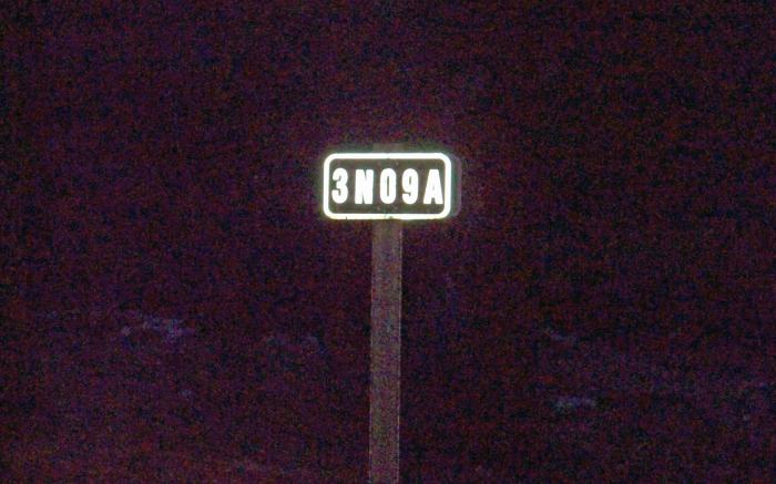
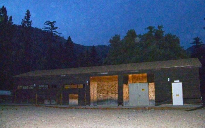
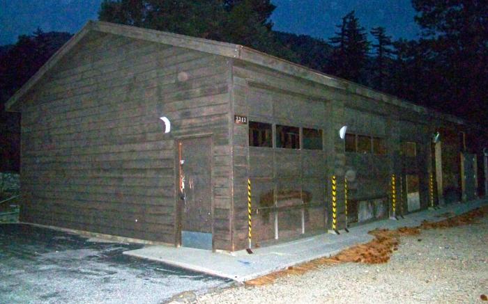


with a street address of "2212", and a code designation of "3N09A" (posted on a sign at the entry),
this Fire Station (and its Camp-like surrounds) appear to have been abandoned some recent years ago…
while there is some evidence of vandalism, the area appears mostly intact, aside from the declining condition of the structures themselves…
There is also some evidence of horticultural projects having been conducted on the grounds, perhaps having to do with the "staging" of new seedlings to be introduced into the forest, but this is only speculation on the author's part...
Nearby cities:
Coordinates: 34°18'59"N 117°50'29"W
- Means Dry Lake 122 km
- Devils Playground 195 km
- Little Dumont Dunes 206 km
- Six Spring Canyon 207 km
- Supersonic Low Level test area 213 km
- Val Jean Dunes 217 km
- Deb Analog 219 km
- Olancha Dunes 222 km
- Rainbow Canyon / The Jedi Transition 231 km
- Goodsprings, Nevada 276 km
- Mount Waterman Ski Lifts 8.8 km
- Devil's Punchbowl Natural Area 11 km
- Angeles National Forest 18 km
- Pearblossom, California 21 km
- Pearblossom Pumping Plant 23 km
- Littlerock, California 26 km
- Lake Los Angeles, California 33 km
- Lake Palmdale 37 km
- San Andreas Fault Zone (approximate) 55 km
- San Andreas Fault (Zone) 72 km